
Local time Sunday 5:43 PM | Established 1990 | |
 | ||
Weather 8°C, Wind NW at 18 km/h, 56% Humidity Restaurants River Hill Sports Grille, Ledo Pizza, Ruby Tuesday, Red Pearl Chinese Restaurant, Subway | ||
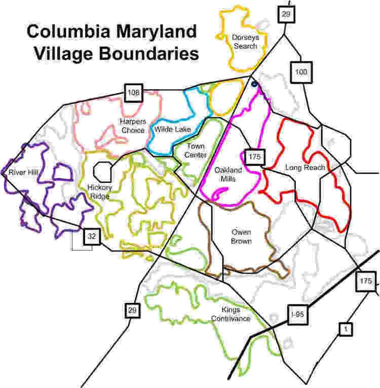
River Hill is the last and westernmost village to be developed in the town of Columbia, Maryland, though some residents have addresses in Clarksville. The village is home to 6,520 residents in 2,096 housing units in 2014. The area was used as a game preserve by James Rouse to entertain clients and personal hunting during the buildout of the Columbia project. In 1976, County Executive Edward L. Cochran selected the 784-acre parcel owned by Howard Research and Development for an alternate location for a county landfill; a task force selected Alpha Ridge Landfill instead. Residential construction started in 1990. It is bounded by Maryland Route 108 and Maryland Route 32, and is centered on Trotter Road. The village is divided into two neighborhoods: Pheasant Ridge and Pointers Run, with about 6,500 residents.
Contents
Map of River Hill, Columbia, MD, USA
The original plan called for the village to be connected to the rest of Columbia via an extension of Little Patuxent Parkway. In addition, a dam on the Middle Patuxent River would have created a large lake in that watershed. However, with the rise of the environmental movement, a large part of the watershed was made into a park. with about half of its acreage devoted to open space, which includes the 900 acres (3.6 km2) of the Middle Patuxent Environmental Area. In 1998, the county initiated managed deer hunting in River Hill, becoming the first time hunting was permitted in the Columbia development since the land purchases of 1963–1966. River Hill is largely disconnected from the rest of the city, accessing Columbia Town Center only by roads on the periphery of the city.
The original plan called for 90 acres (360,000 m2) to be devoted to apartments, but the rural neighbors wanted a lower population density. The county zoning board decided upon 33 acres (130,000 m2) for apartments. Consequently, River Hill has the most open space of all the villages.
Names
River Hill is named for River Hill Farm, claimed to be one of the first plantations in Maryland to free its slaves, and demolished by the Rouse Company to build Pointer's Run. River Hill consists of the communities of Pheasant Ridge and Pointer's Run. Pheasant Ridge is named after Henry Howard's (1772–1773) 195-acre slave plantation land tract patented on November 16, 1745, later inherited by John Beal Howard.
The street names come from the works of Walt Whitman and James Whitcomb Riley.
Services
The village center includes a Giant Food, McDonald's, Ruby Tuesday, Bagel Bin and Deli, Ledo Pizza, Subway, The UPS Store, Chevy Chase Bank, a liquor store, a dry cleaner, an optometrist, the River Hill grill restaurant, and a Hair Cuttery.
An athletic club (Columbia Gym) is located near the village center and has an indoor pool, basketball court, and multiple workout areas. The village also has an outdoor pool.
The River Hill Community Association offices are located in Claret Hall in the River Hill Village Shopping Center.
Education
The Howard County Public School System is a shared public school system serving the village: