
Country United Kingdom | ||
 | ||
Similar National Trust ‑ Heddon, Valley of the Rocks, Woody Bay - Devon, Watersmeet House, Hangman cliffs | ||
The River Heddon is a river in Devon, in the south of England. Running along the western edges of Exmoor, the river reaches the North Devon coast at Heddon's Mouth. The nearest road access to the beach is at Hunter's Inn, approximately 2 km south of sea-fall.
Map of River Heddon, United Kingdom
The Heddon Valley is renowned for its natural beauty, with bridges and stepping stones along the river, meadows full of flowers and easy walks which start from the National Trust shop and information centre which has been in the ownership of the National Trust since 1963.
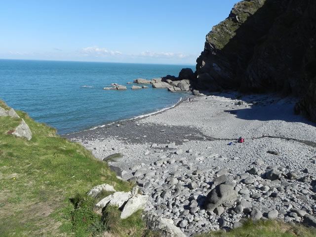
The cobbled beach at Heddon's Mouth is approximately 300m wide and is only accessible through footpaths on the National Trust land or via the South West Coast Path. There are remains of a lime kiln on its western edge. The valley immediately landwards of the beach has very steep slopes to its east and west, with the hills climbing over 200 m in altitude within 500 m of the river. The remains of a Roman fortlet are visible on the hilltop immediately to the east of Heddon's Mouth.
The Lynton & Barnstaple Railway once ran through part of the valley, halting at the small village of Parracombe.