
Source Kirkby-in-Ashfield Country United Kingdom | Mouth River Trent Bridges Bennerley Viaduct | |
 | ||
- location south east of Kirkby-in-Ashfield - location confluence with River Trent at Attenborough Nature Reserve | ||
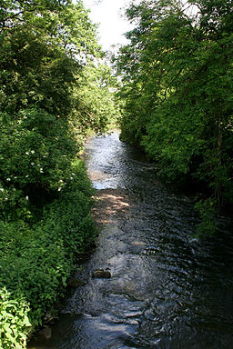
The River Erewash /ˈɛrᵻˌwɒʃ/ is a river in England that flows roughly southwards through Derbyshire, close to its eastern border with Nottinghamshire.
Contents
Map of River Erewash, United Kingdom
EtymologyEdit
The approximate meaning of the name is not in doubt, but there is room for debate about the precise derivation and its connotations. Brewer gives the commonly accepted explanation that it comes from the Old English words irre ("wandering") and wisce ("wet meadow"). This is accepted by Cameron, a leading place name expert, and a Derbyshire specialist, who interprets the name as "wandering, marshy river". Gelling, who specialises in seeking precise topgraphical equivalents for toponymic elements, confirms that wisce signifies a marshy meadow but gives only southern examples. She conjectures that there is an element, wæsse, perhaps Old English, that signifies very specifically "land by a meandering river which floods and drains quickly", and her examples are primarily Midland and northern. This seems to fit the Erewash perfectly. A good example of the meandering character of the river will be seen around Gallows Inn Playing Fields, Ilkeston, where rapid flooding and draining occur frequently. As she meanders through Toton and Long Eaton the river crosses Manor Park which has the Norfolk Brook running adjacent to it. When there has been prolonged rain fall the two waters are prone to burst their banks and meet over the football pitches and the cricket pitch. The name is pronounced locally as 'Erry-wash'.
CourseEdit
The Erewash rises in Kirkby-in-Ashfield, Nottinghamshire, but is partly culverted as it flows south westward from the town. It surfaces definitively to the north of Kirkby Woodhouse and flows roughly westward, under the M1 motorway, and between Pinxton and Selston. It then becomes the approximate county boundary between Nottinghamshire and Derbyshire, flowing roughly south, between Langley Mill and Eastwood, skirting the east of Ilkeston, where it becomes also the boundary of the Borough of Erewash. The river continues south between Sandiacre and Stapleford until, at Toton, it turns east and flows into the River Trent, at the Attenborough Nature Reserve, near Long Eaton.
It gives its name to the Erewash Valley, which has a rich industrial history, and the local government district and borough of Erewash, which was named after the river when the former borough of Ilkeston and urban district of Long Eaton were united with some of the surrounding rural areas in 1974.
Although the river is not navigable at any part, it is paralleled by the Erewash Canal for much of its length, from (Langley Mill to the River Trent); north of Langley Mill, it was paralleled by the abandoned Cromford Canal (from the branch to Pinxton).
Literary associationsEdit
For such a small river, the Erewash has a surprisingly high literary profile, due almost entirely to D.H. Lawrence, who mentions it several times, and centres a number of works in the Erewash valley. A reference at the beginning of The Rainbow is perhaps the most telling from the geographical point of view:
"The Brangwens had lived for generations on the Marsh Farm, in the meadows where the Erewash twisted sluggishly through alder trees, separating Derbyshire from Nottinghamshire."