
- elevation 0 ft (0 m) | ||
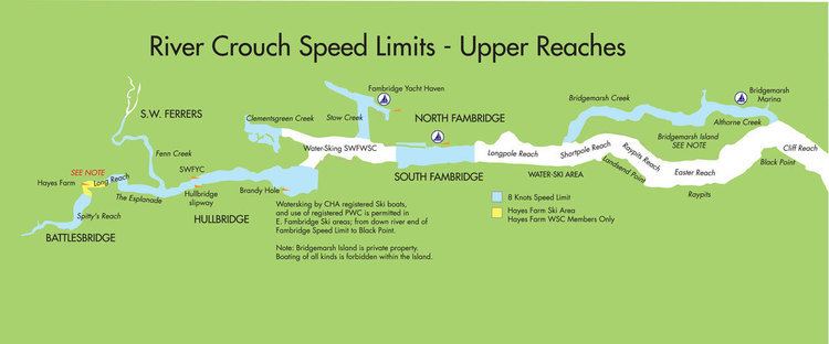 | ||
- left Fenn Creek, Clementsgreen Creek, Stow Creek, Bridgemarsh Creek - location Between Holliwell Point and Foulness Point | ||
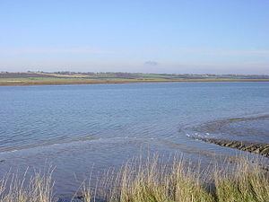
Sailing on the river crouch
The River Crouch is a river that flows entirely through the English county of Essex.
Contents
- Sailing on the river crouch
- River crouch crossing 5ft tide inbound
- RouteEdit
- The River Crouch Conservation TrustEdit
- The Crouch Harbour AuthorityEdit
- References
The distance of the Navigation between Holliwell Point which is north of Foulness Island and Battlesbridge is 17.5 Miles, i.e. 15.21 Nautical Miles.
The river was once known as the Huolve or Wholve and this name is the basis of the name of the town of Hullbridge.
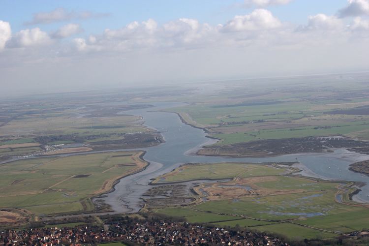
River crouch crossing 5ft tide inbound
RouteEdit
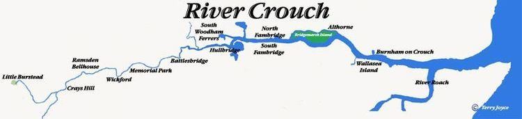
The Crouch rises in 'The Wilderness' on the Burstead Golf course at Little Burstead. The Wilderness is a pond surrounded by a tiny area of ancient woodland. It runs parallel with the A176 (Noak Hill Road) for approximately 1.3 miles (2.1 km) and then follows a generally easterly course, passing by, near or through:
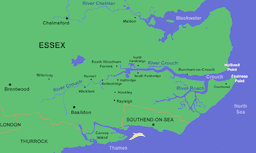
The river flows into the North Sea between Holliwell Point (grid reference TR026963) and Foulness Point (TR048954) on its north and south banks respectively.
A major tributary of the River Crouch is the River Roach.
The River Crouch Conservation TrustEdit
The River Crouch Conservation Trust was set up in July 2009 by a group of concerned local people, mainly fisherman, after a stretch of the river around Memorial Park, Wickford was badly polluted. Its aim is to clear the river of rubbish and to bring the river back to a quality which will benefit all forms of wildlife, from water voles, fish to invertebrates and for the benefit of the public.
The Crouch Harbour AuthorityEdit
The Crouch Harbour Authority is the statutory harbour and navigation authority for the Rivers Crouch and Roach, extending some distance into the Thames Estuary, and controls both pleasure and commercial use of the rivers. The authority, created via the Crouch Harbour Act 1974, is run not-for profit and funded by dues levied on vessels kept on the river. Its tasks include passing and enforcing bylaws that regulate use of the river, providing pilotage and buoying/marking the navigable channels. They also provide weather forecasts, tide tables and other important sailing information. The Harbourmaster's Office is on the Quay at Burnham on Crouch.