
Native name Abhainn an Chláir River mouth 5 metres (16 ft) Length 93,000 m | Etymology River of the plain Basin size 1,108 km (428 sq mi) Province Connacht | |
 | ||
Tributaries Left:Grange River, Sinking River | ||
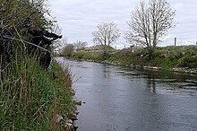
The River Clare (Irish: Abhainn an Chláir) is a river in counties Mayo and Galway in Ireland.
Map of River Clare, Co. Galway, Ireland
The 93 kilometres (58 mi) long river rises north of Ballyhaunis in Mayo and descends past Dunmore, where it flows west, then turns south past Milltown, continuing down through Kilbennan Church near Tuam. It continues south until past Turloughmore, then turns sharply west, flowing north of Claregalway and, thence, further westward into Lough Corrib. From there it flows as the River Corrib into Galway Bay.
A large section of it is a former turlough (Irish: turlach), which, at 6.5 square kilometres, used to be Ireland's largest.
The Clare is the longest river in the Lough Corrib catchment. It has since the 1960s been subject to ongoing arterial drainage to lower the bed of the river and mitigate flooding. This has resulted in the river being straightened and canalized between ramparts of dredge material making access to the river difficult and compromising its value as a public amenity. It is an important spawning channel for salmon and trout and a noted fishery in its own right for both species. Many young teenagers also swim in it during the summer