
Length 240 km Country Vietnam | Mouth Gulf of Tonkin Mouth elevation 0 | |
 | ||
Region Hà Nội, Hòa Bình, Hà Nam, Ninh Bình and Nam Định Main source Geladaindong Peak, Tanggula Mountains, Qinghai (Đan Phượng)
5,042 m (16,542 ft) River mouth Đáy Mouth, Kim Sơn
0 m (0 ft) | ||
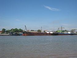
The Day River (Vietnamese: Sông Đáy) is a river in Vietnam. It was formerly known as Sông Hát or Hát Giang. The river is a distributary of the Red River, draining into the Gulf of Tonkin.
Map of S%C3%B4ng %C4%90%C3%A1y, Vietnam
The river has a length of 240 km and has a drainage basin of more than 7,500 km², flowing through Hanoi, and the provinces of Hòa Bình, Hà Nam, Ninh Bình and Nam Định.
References
River Đáy Wikipedia(Text) CC BY-SA