
OS grid reference SU722632 Post town READING Dialling code 0118 | Sovereign state United Kingdom Postcode district RG7 | |
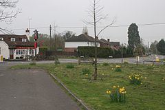 | ||
Riseley is a village in the English county of Berkshire, adjacent to the border with Hampshire. It is located around 6 miles (9.7 km) south of Reading and 8 miles (13 km) north-east of Basingstoke, and is bypassed to the west by the A33 road.
Map of Riseley, Reading, UK
For local government purposes, the village is today within the civil parish of Swallowfield, which in turn is within the unitary authority of Wokingham.
Before 1844, Riseley was part of a detached portion, or exclave, of the county of Wiltshire, some 30 miles to the west. The Counties (Detached Parts) Act of that year resulted in its transfer to Berkshire.
References
Riseley, Berkshire Wikipedia(Text) CC BY-SA