
Website www.ripleycounty.com Founded 1818 Unemployment rate 5.2% (Apr 2015) | Largest city Batesville Area 1,160 km² Population 28,419 (2013) | |
 | ||
Named for Eleazer Wheelock Ripley Rivers Laughery Creek, Muscatatuck River, Pipe Creek Points of interest Liberty Park, Versailles State Park, Ripley County Parks & R, Ripley County Historical, Ertel Cellars Winery Inc | ||
Ripley County is a county located in the U.S. state of Indiana. As of 2010, the population was 28,818. The county seat is Versailles.
Contents
- Map of Ripley County IN USA
- History
- Geography
- Cities and towns
- Townships
- Adjacent counties
- Major highways
- National protected area
- Climate and weather
- Government
- Demographics
- References
Map of Ripley County, IN, USA
History
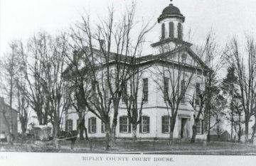
Ripley County was formed in 1816. It was named for Gen. Eleazer Wheelock Ripley, an officer in the War of 1812, who was mainly remembered for the Battle of Lundy's Lane and the Siege of Fort Erie, in 1814.
Geography
According to the 2010 census, the county has a total area of 448.06 square miles (1,160.5 km2), of which 446.43 square miles (1,156.2 km2) (or 99.64%) is land and 1.64 square miles (4.2 km2) (or 0.37%) is water.
Cities and towns
Townships
Adjacent counties
Major highways
National protected area
Climate and weather
In recent years, average temperatures in Versailles have ranged from a low of 18 °F (−8 °C) in January to a high of 84 °F (29 °C) in July, although a record low of −28 °F (−33 °C) was recorded in January 1994 and a record high of 100 °F (38 °C) was recorded in July 1999. Average monthly precipitation ranged from 2.71 inches (69 mm) in February to 5.27 inches (134 mm) in May.
Government
The county government is a constitutional body, and is granted specific powers by the Constitution of Indiana, and by the Indiana Code.
County Council: The county council is the legislative branch of the county government and controls all the spending and revenue collection in the county. Representatives are elected from county districts. The council members serve four-year terms. They are responsible for setting salaries, the annual budget, and special spending. The council also has limited authority to impose local taxes, in the form of an income and property tax that is subject to state level approval, excise taxes, and service taxes.
Board of Commissioners: The executive body of the county is made of a board of commissioners. The commissioners are elected county-wide, in staggered terms, and each serves a four-year term. One of the commissioners, typically the most senior, serves as president. The commissioners are charged with executing the acts legislated by the council, collecting revenue, and managing the day-to-day functions of the county government.
County Officials: The county has several other elected offices, including sheriff, coroner, auditor, treasurer, recorder, surveyor and circuit court clerk. Each of these elected officers serves a term of four years and oversees a different part of county government. Members elected to county government positions are required to declare party affiliations and to be residents of the county.
Ripley County is part of Indiana's 6th congressional district and is represented in Congress by Republican Luke Messer.
Demographics
As of the 2010 United States Census, there were 28,818 people, 10,789 households, and 7,910 families residing in the county. The population density was 64.6 inhabitants per square mile (24.9/km2). There were 11,952 housing units at an average density of 26.8 per square mile (10.3/km2). The racial makeup of the county was 97.6% white, 0.5% Asian, 0.2% American Indian, 0.2% black or African American, 0.5% from other races, and 0.9% from two or more races. Those of Hispanic or Latino origin made up 1.5% of the population. In terms of ancestry, 43.4% were German, 14.2% were American, 13.9% were Irish, and 8.7% were English.
Of the 10,789 households, 36.2% had children under the age of 18 living with them, 58.1% were married couples living together, 10.2% had a female householder with no husband present, 26.7% were non-families, and 22.8% of all households were made up of individuals. The average household size was 2.63 and the average family size was 3.08. The median age was 39.2 years.
The median income for a household in the county was $47,697 and the median income for a family was $57,305. Males had a median income of $41,711 versus $31,927 for females. The per capita income for the county was $22,025. About 7.5% of families and 9.8% of the population were below the poverty line, including 14.3% of those under age 18 and 8.6% of those age 65 or over.