
Country United States County Santa Cruz FIPS code 06-60928 Elevation 44 m Zip code 95003 Area code 831 | State California Time zone PST (UTC-8) GNIS feature ID 1659513 Area 11.94 km² Population 9,216 (2010) | |
 | ||
Rio del Mar (From Spanish: Río del Mar, meaning River of the Sea) is a census-designated place (CDP) in Santa Cruz County, California, United States. The name "Rio Del Mar" was chosen as a "catchy" name to promote real estate in the area during the 1920s. There is no body of water by that name in Santa Cruz County. But there is a large creek, Aptos Creek, that goes through Rio del Mar and empties into the Monterey Bay at Rio del Mar. Aptos Creek is the "Rio" in Rio del Mar. The population was 9,216 at the 2010 census.
Contents
Map of Rio Del Mar, CA, USA
Geography
Rio del Mar is located at 36°57′50″N 121°53′16″W (36.963764, -121.887690).
According to the United States Census Bureau, the CDP has a total area of 4.6 square miles (12 km2), of which, 3.0 square miles (7.8 km2) of it is land and 1.6 square miles (4.1 km2) of it (34.94%) is water.
2010
The 2010 United States Census reported that Rio del Mar had a population of 9,216. The population density was 1,998.3 people per square mile (771.5/km²). The racial makeup of Rio del Mar was 8,310 (90.2%) White, 61 (0.7%) African American, 50 (0.5%) Native American, 313 (3.4%) Asian, 7 (0.1%) Pacific Islander, 188 (2.0%) from other races, and 287 (3.1%) from two or more races. Hispanic or Latino of any race were 899 persons (9.8%).
The Census reported that 9,210 people (99.9% of the population) lived in households, 6 (0.1%) lived in non-institutionalized group quarters, and 0 (0%) were institutionalized.
There were 3,916 households, out of which 1,050 (26.8%) had children under the age of 18 living in them, 2,082 (53.2%) were opposite-sex married couples living together, 337 (8.6%) had a female householder with no husband present, 139 (3.5%) had a male householder with no wife present. There were 228 (5.8%) unmarried opposite-sex partnerships, and 32 (0.8%) same-sex married couples or partnerships. 1,008 households (25.7%) were made up of individuals and 486 (12.4%) had someone living alone who was 65 years of age or older. The average household size was 2.35. There were 2,558 families (65.3% of all households); the average family size was 2.82.
The population was spread out with 1,820 people (19.7%) under the age of 18, 549 people (6.0%) aged 18 to 24, 1,932 people (21.0%) aged 25 to 44, 3,221 people (35.0%) aged 45 to 64, and 1,694 people (18.4%) who were 65 years of age or older. The median age was 47.0 years. For every 100 females there were 92.6 males. For every 100 females age 18 and over, there were 90.2 males.
There were 4,924 housing units at an average density of 1,067.6 per square mile (412.2/km²), of which 2,848 (72.7%) were owner-occupied, and 1,068 (27.3%) were occupied by renters. The homeowner vacancy rate was 1.9%; the rental vacancy rate was 8.4%. 6,686 people (72.5% of the population) lived in owner-occupied housing units and 2,524 people (27.4%) lived in rental housing units.
2000
As of the census of 2000, there were 9,198 people, 4,008 households, and 2,549 families residing in the CDP. The population density was 3,077.3 people per square mile (1,187.7/km²). There were 5,022 housing units at an average density of 1,680.2 per square mile (648.5/km²). The racial makeup of the CDP was 91.74% White, 0.61% African American, 0.53% Native American, 2.58% Asian, 0.16% Pacific Islander, 1.87% from other races, and 2.51% from two or more races. Hispanic or Latino of any race were 6.46% of the population.
There were 4,008 households out of which 25.4% had children under the age of 18 living with them, 53.0% were married couples living together, 7.4% had a female householder with no husband present, and 36.4% were non-families. 26.0% of all households were made up of individuals and 10.4% had someone living alone who was 65 years of age or older. The average household size was 2.29 and the average family size was 2.74.
In the CDP, the population was spread out with 19.2% under the age of 18, 5.8% from 18 to 24, 26.8% from 25 to 44, 31.9% from 45 to 64, and 16.3% who were 65 years of age or older. The median age was 44 years. For every 100 females there were 92.3 males. For every 100 females age 18 and over, there were 90.9 males.
The median income for a household in the CDP was $75,282, and the median income for a family was $85,355. Males had a median income of $70,612 versus $41,449 for females. The per capita income for the CDP was $39,034. About 3.1% of families and 6.3% of the population were below the poverty line, including 4.5% of those under age 18 and 4.6% of those age 65 or over.
Government
In the California State Legislature, Rio del Mar is in the 17th Senate District, represented by Democrat Bill Monning, and in the 29th Assembly District, represented by Democrat Mark Stone.
In the United States House of Representatives, Rio del Mar is in California's 20th congressional district, represented by Democrat Jimmy Panetta.
Parks and recreation
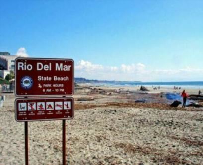
Rio del Mar neighbors Seacliff State Beach, which features the remains of the cement ship, the SS Palo Alto. The ship was launched May 29, 1919. It was too late for duty in World War I, and after the war was beached as an entertainment boat, with amenities including a dance floor, a swimming pool and a cafe. Today, it remains swamped, broken, and off-limits, adjoining a fishing pier.
Rio del Mar is known locally as the Rio Del Mar Flats. The surrounding area is a combination of tourist destination, summer rentals, and up-scale residences. Many of the homes in or near the Flats are of the beachcomber type, two-story townhouses with balconies and carports.