
Local time Thursday 11:48 AM | ||
 | ||
Weather 26°C, Wind S at 11 km/h, 53% Humidity | ||
Rio das flores camerata rioflorense rio de janeiro tv riotur
Rio das Flores is a municipality located in the Brazilian state of Rio de Janeiro. Its population was 8,361 (2005) and its area is 478 km².
Contents
- Rio das flores camerata rioflorense rio de janeiro tv riotur
- Map of Rio das Flores State of Rio de Janeiro Brazil
- History
- Tourism in Rio das Flores
- References
Map of Rio das Flores - State of Rio de Janeiro, Brazil
History
Before the arrival of the first Portuguese settlers in the 16th century, the region was inhabited by “puri” Amerindians. The region began to be colonized more intensively on the 19th century, during the “Coffee Cycle”. In 1851, a chapel was built dedicated to Santa Teresa, establishing the Parish of Santa Teresa of Valenca. With the coffee plantation, the region began to become very prosperous, to the point that in 1882, a railway station was opened in Rio das Flores to serve the coffee farms.
In 1890, the district emancipated from city of Valencia, becoming the village of Santa Teresa. In 1929 the village was elevated to city status and in 1943, was renamed "City of Rio das Flores." Currently, it has its economy based on agriculture and tourism.
Tourism in Rio das Flores
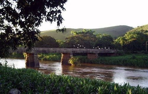
Rio das Flores offers great diversity of attractions for ecotourism, rural tourism, adventure and sports, religious tourism and historical and cultural - delighting visitors. The fertile lands of the valley and climate for coffee have attracted investments in the past for the construction of large farms, today visited by many tourists.