
Country Argentina University National University of Rio Negro Area 203,013 km2 | Capital Viedma Governor Alberto Weretilneck Population 678,797 (2013) | |
Rio Negro ( Black River) is a province of Argentina, located at the northern edge of Patagonia. Neighboring provinces are from the south clockwise Chubut, Neuquen, Mendoza, La Pampa and Buenos Aires. To the east lies the Atlantic Ocean.
Contents
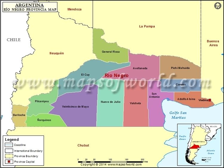
Map of Rio Negro Province
Its capital is Viedma. Other important cities include the ski resort town of Bariloche, Cipolletti and General Roca.
History
Ferdinand Magellan was the first explorer to visit the coasts of the provinces in 1520. Priest Nicolas Mascardi founded the Jesuit mission Nuestra Senora de Nahuel Huapi in 1670 at the shore of the Nahuel Huapi Lake, at the feet of the Andes range.
Francisco Moreno, the eminent explorer and conservationist was granted the area around Nahuel Huapi Lake and established Argentinas National Park System.
In 1779 Francisco Fernandez de Viedma founded both Mercedes de Patagones (current Viedma) and Carmen de Patagones (Buenos Aires Province) on opposite sides of the Rio Negro Rivers mouth.
After the May Revolution there was a first attempt to subdue the aboriginals of the area, but it was not until the Conquest of the Desert commanded by General Julio Argentino Roca that the local inhabitants were reduced and the constant danger of their attacks eliminated. Francisco Moreno started his exploration of the Patagonia at the Nahuel Huapi Lake area to later adventure further south.
By the beginning of the 19th century, many settlements such as San Carlos de Bariloche, General Roca and Choele Choel were already constituted and received French and German immigration, and other such as Cipolletti, Ingeniero Huergo and others installed in the Alto Valle (Upper Valley) region. Soon the production of fruits became the main economical activity, and the railway connected the Alto Valle with the ports on the Atlantic Ocean.
Rio Negro acquired status of province on December 10, 1957; its first governor was Edgardo Castello of the Radical Civic Union (UCR).
Geography and climate
At the north of the Patagonia, the Limay River serves as natural border with the Neuquen Province to the West, as the Colorado River does with La Pampa Province to the North. The 42nd parallel south marks the southern limit of the province.
The main water source at the arid plains that cover most of the province is the Rio Negro River, in whose valley most of the settlements and farms are located. The over 600 km of the Rio Negros valley are divided in Alto Valle (West), Valle Medio (center) and Valle Inferior (East).
The central part of the province is dominated by a series of plateaus and isolated hills, with altitudes ranging from 600 meters (2000 ft) above sea level to 1000 meters (3300 ft). Especially noteworthy is the plateau called "Meseta de Somuncura" in the central-eastern part of the province, with altitudes generally above 1000 meters (3300 ft) and some spots reaching 1300 meters (4200 ft). Moving further west, the foothills of the Andes are dominated by a series of low valleys discharging either towards the Atlantic through the Limay river, or to the Pacific through the Manso and Puelo rivers: deep blue-water lakes form in the Andean valleys, with some regions reaching very low altitudes (under 400 meters, or 1300 ft, in the Pacific basin, and 750 meters, or 2500 ft, in the Atlantic basin). The Andes are here deeply cut by glacial valleys, and the altitude of the peaks is moderate: for most, it ranges between 1,700 meters and 2,200 meters (5600 to 7200 ft), with only a handful of peaks surpassing 2,400 meters (7800 ft). Especially noteworthy is the Cerro Tronador, a heavily glaciated peak of 3,405 meters (11,100 ft) which clearly dominates the surrounding landscape.
The climate of the province is temperate at low elevations, and very cold in the higher Andean peaks. Several variations occur in the province, but we can distinguish 5 main climatic regions:
The Atlantic coast has a very dry, moderate climate. The existence of warm currents creates higher temperatures than in regions further north in the province of Buenos Aires: summers are hot, with highs between 28 °C (82 °F) and 32 °C (91 °F) and nights are pleasant, at 15 °C (59 °F) to 18 °C (64 °F). The air is very dry, and precipitation is only about 30 mm (1.2 in) monthly during the season, falling in the form of isolated thunderstorms. Temperatures cool down with the start of fall in March, and by April, one can expect highs of 20 °C (69 °F) and lows of 10 °C (50 °F) along the coast. Winter is surprisingly mild for Patagonian standards, and very dry: highs average 12 °C to 15 °C (54F to 59F) and lows between 1 °C and 4 °C (34 °F to 39 °F). Temperatures will sometimes fall down to -10 °C (14 °F) and snow or sleet showers can occur sometimes, but they remain infrequent. Spring is progressively warmer but extremely windy. Total precipitation averages only 250 to 300 mm (9.8 in to 11.8 in).
The Rio Negro Valley and Colorado Valley run through the northern part of the province, the latter forming the border with the province of La Pampa. They cut deep, fertile valleys that form irrigated oases (especially the Rio Negro) with a climate that is markedly warmer than most regions of the province: summers are very hot, usually above 30 °C (86 °F) during the day and sometimes up to 40 °C (104 °F) followed by relatively cool nights, and thunderstorms are more frequent further north. Winters are similar to those along the coast but nights tend to be colder, with average lows of just about 0 °C (32 °F). Precipitation ranges from 450 mm in the extreme northeast corner (helped by summer thunderstorms), to under 200 mm in the northwestern part, distributed quite evenly with a slight peak in the spring and summer.
The Western foothills and Andean valleys have a cool climate with heavy rain and frequent snow. Summers are windy, sunny and cool (averaging about 22C, or 71F, during the day and 6C, or 44F, at night) while winters average 6C (44F) during the day and -2C (29F) at night at low altitudes. Rainfall is moderate to low in the summer, and extremely abundant in the fall and winter, with areas recording up to 4,500 mm of rain (although values between 1,500 and 2,500 are more typical)
The central Plateau areas have an arid, continental climate, with warmer summers (usually near 25C) and cold winter nights. Temperatures of -25C have been recorded in the city of Maquinchao, with unofficial lows of up to -35C measured in several locations. Because of this climate, the area is very sparsely populated.
Finally, higher altitudes have colder temperatures: above 1200 meters (3900 ft), snow cover will usually last for about 3 to 5 months every year, and many summer rainstorms will leave a dusting of snow during the night. At 1600 meters, snow frequently reaches depths of over 1.5 meters (over 5 feet) and lasts until early summer. The tree line is located at 1600 meters (5200 ft) in southerly slopes and 1800 (5900 ft) in northerly slopes; at 2000 meters (6600 ft), pockets of snow remain until late summer in the shade and at about 2400 meters (7900 ft), eternal snow is present. The weather is unpredictable at these heights, and is always extremely cold and windy on top of Cerro Tronador.
Economy
Argentinas ninth-largest, Rio Negros economy is a diversified service-based one with vigorous agricultural and light manufacturing sectors. Its 2006 output was an estimated US$5.4 billion, and now the per capita income is of US$16,800 . The provinces agriculture (about 10% of output) is concentrated in the fertile valleys of the Rio Negro River, specially at the Alto Valle but also at the Valle Medio. The province produces almost 70% of the apples and pears of the country, most it for exportation with 38% of it as fresh fruit and 40% as juice concentrate, through the port of San Antonio Oeste.
Tourism
There are two main areas of tourism in the province; the Andes and the Atlantic coast.