
Population 9,748 (2011 census) Postal code 3135 | Postcode(s) 3135 Area 4.9 km² | |
 | ||
Location 25 km (16 mi) from Melbourne | ||
Ringwood East is a suburb of Melbourne, Victoria, Australia, 25 km east of Melbourne's Central Business District. Its local government area is the City of Maroondah. At the 2011 Census, Ringwood East had a population of 9,748.
Contents
- Map of Ringwood East VIC 3135 Australia
- Burnt Bridge
- Sporting clubs
- Internet Personalities
- Secondary schools
- Primary schools
- References
Map of Ringwood East VIC 3135, Australia
It is located in the "Green Belt" of Melbourne, with a lot of native trees and wildlife preserved in areas such as Wombalono Park and its surrounding suburban streets.
The access to high performing public schools, such as Ringwood Secondary College, as well as renowned private schools Tintern Girls Grammar and Aquinas College, is leading to high demand for housing in Ringwood East. The area is now being seen as a real life-style option by people who may have previously looked to areas, such as Balwyn and Camberwell, for quality schools.
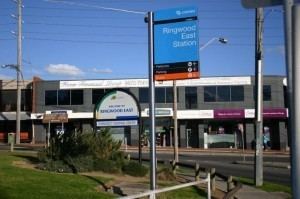
Ringwood East has its own railway station and is a Zone 2 station on the Lilydale railway line.
Ringwood East Post Office opened around 1902, in what was then a rural area, before the railway station opened in 1925.
Burnt Bridge
Burnt Bridge is a locality within the suburb. It is named after the Burnt Bridge Hotel, which was operated by Elizabeth Moore and Lucy Dawson as early as the 1840s and was located along the Lilydale Trail, near the present day junction of Maroondah Highway, Old Lilydale Road and Beaufort Roads. At the time of the hotel's existence, the area was grazing land. Hotels in these times usually began as shanties, selling coffee to passing coaches, before gaining their liquor licences.
Although some historians have speculated that the name is derived from the Scottish word 'burn', meaning 'stream', it is more popularly believed to be derived from a canvas toll bridge in the area, which was burnt down. The hotel was also known to locals as 'The Blazing Stump'.
The shopping precinct serves residents from both sides of Maroondah Highway and from as far as Mount Dandenong Road.
Sporting clubs
The suburb has an Australian Rules football team, the East Ringwood Roos, competing in the Eastern Football League.
They are based at the reserve located on the corner of Mount Dandenong Road and Dublin Road but used to play on a field which is now the site of Maroondah Hospital. The East Ringwood Cricket Club and Tennis Club are also based at the reserve.