
Highest elevation 83 m (272 ft) Elevation 83 m | Archipelago Australes Highest point Mount Uahu Administrative subdivision Australes Area 8.6 km² | |
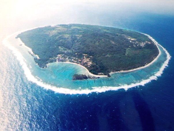 | ||
Rimatara is the westernmost inhabited island in the Austral Islands of French Polynesia. It is located 550 km (340 mi) south of Tahiti and 150 km (93 mi) west of Rurutu. The commune of Rimatara includes the small and uninhabited Maria Islands.
Contents
Map of Rimatara
Rimatara is a circular volcanic plateau surrounded by a reef with a height of 8 to 10 meters (26 to 32 feet). The highest point, at the peak of Mount Uhau, is 83 meters (272 feet). The main villages are Amaru (the capital), Anapoto and Mutuaura.
Rimatara was one of the last Polynesia islands to welcome European visitors. Captain Samuel Pinder Henry discovered the island in 1821. Two missionaries arrived in 1822 and established a Protestant mission. France established a protectorate in 1889 and annexed Rimatara in 1900.
Administration
The commune of Rimatara consists of the island of Rimatara, and the Maria Islets (Îlots Maria). Rimatara consists of the following associated communes: