Tripti Joshi (Editor)

Rigobert Bonne

Updated on
Edit
Like
Comment
Share on FacebookTweet on TwitterShare on LinkedInShare on Reddit
Name
  
Rigobert Bonne


Died
  
1795, Paris, France

In a room with brown walls, Rigobert Bonne is serious, standing with his left hand resting on the books, with his right hand holding a pipe, has bald top and long brown side hair and a mustache wearing an black scholar's robe with white collar.

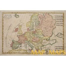
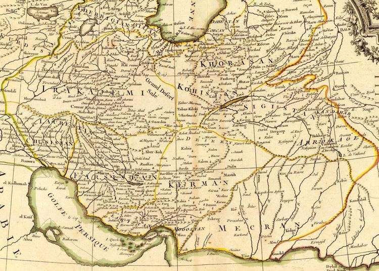
Rigobert Bonne (6 October 1727 – 2 September 1794) was one of the most important cartographers of the late 18th century.

Contents

Map of Asia Turkey. Almost entirely containing Anatolia, Georgia, Armenia, Kurdistan, Alge-zira, Iraq-Arabi, Syria, it has black,brown,orange  and red lines and grid lines. At the top left, has a styled border with a word written “ CARTE DELATURQUE D’ASIE”

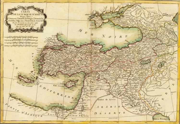
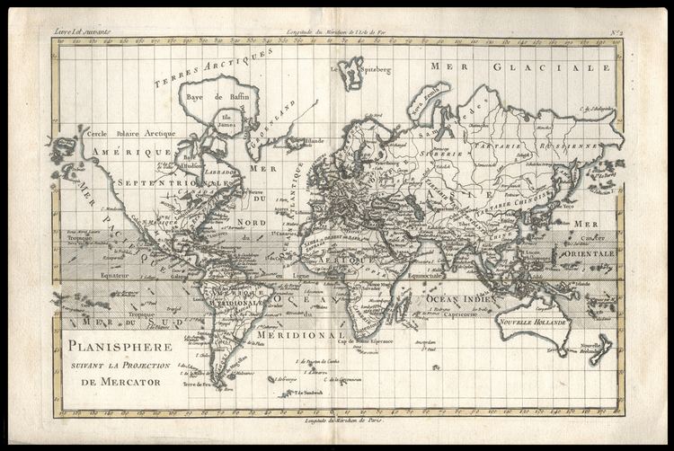
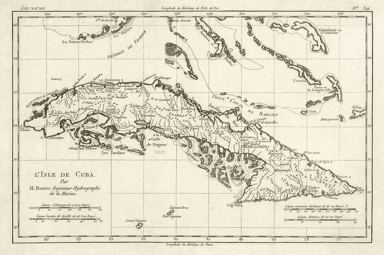
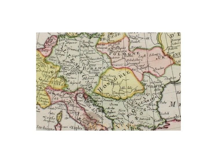
In 1773 Bonne succeeded Jacques Nicolas Bellin as Royal Cartographer to France in the office of the Hydrographer at the Depôt de la Marine. Working in his official capacity, Bonne compiled some of the most detailed and accurate maps of the period. Bonne’s work represents an important step in the evolution of the cartographic ideology away from the decorative work of the 17th and early 18th century towards a more detail oriented and practical aesthetic. With regard to the rendering of terrain Bonne maps bear many stylistic similarities to those of his predecessor, Bellin. However, Bonne maps generally abandon such common 18th century decorative features such as hand coloring, elaborate decorative cartouches, and compass roses.

The Historic Map 1791 of Les Indes Orientales et leur Archipel, on a brown paper has black, yellow, green, and orange lines, grind lines, lands and island with names written on it. At the top right is rock with plants flowers and boxes, with a word written in the middle “Les Indes Orientales et leur Archipel”

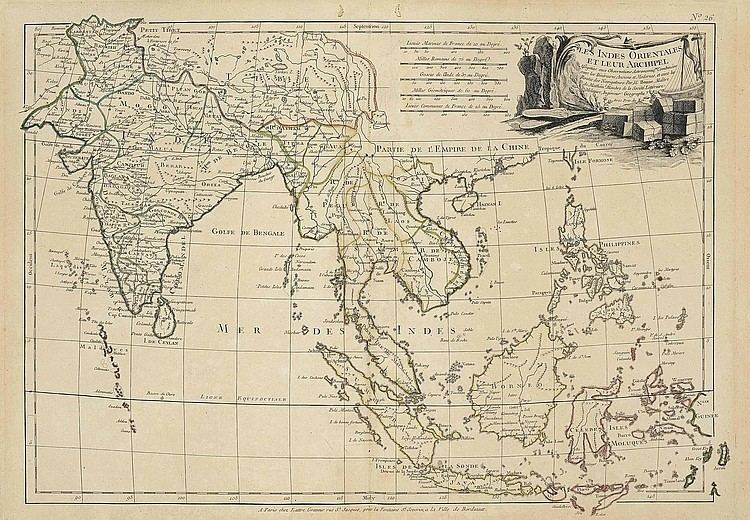
While mostly focusing on coastal regions, the work of Bonne is highly regarded for its detail, historical importance, and overall aesthetic appeal.

On a brown paper Has grid lines, black, yellow, orange and red lines,Map of the Persian Empire.  Projected and subject to Astron observations. by Mr. Bonne, King's Hydrographer. In Paris, Chez Lattre Graveur, ordinary of Monsegur. the Dauphin, rue S. Jacques in the City of Bordeaux. With the privilege of the King. 1787.

Bonne's Projection, Polyconic Projection and Sinusoidal Projection


Principal Works

On a brown paper Has grid lines, black A fine example of Rigobert Bonne and G. Raynal’s 1780 map of the world on a Mercator Projection. Offers a fairly advanced perspective of the world showing the most recent discoveries and explorations.

  • Maps for Guillaume Raynal's Atlas de toutes les parties connues du Globe Terrestre (Geneva, 1780)
  • Maps for Atlas Encyclopedique ... (2 volumes, Paris, 1788)

  • Rigobert Bonne projection of The regions with the least degree of distortion are those where the circles are less distorted. On a white background is a distorted globe, gas black lines and gray lands and grind lines.

    The map of L'Isle de Cuba, On a brown paper has grid lines, black lines has a long land with small islands, with a word written L'Isle de Cuba on the bottom left.

    The Antique map of Europe, On a white background is a map has grid lines, black lines, and a lands in green, yellow and pink color, with the names on it.

    The Antique map of Europe on a white background is a map has grid lines, black lines, and a lands in green, yellow and pink color, with the names on it at the bottom is a word written MAP MAPS

    References

    Rigobert Bonne Wikipedia