
 | ||
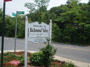
Richmond Valley is the name of a neighborhood located on the South Shore of Staten Island, one of the five boroughs of New York City, the largest city in the United States. Richmond Valley is bordered on the north by Pleasant Plains, to the south by Tottenville, to the west by the Arthur Kill, and to the east by the Lower New York Bay.
Contents
Map of Richmond Valley, Staten Island, NY 10309, USA
Once considered part of Tottenville, Richmond Valley gained a separate identity when the Richmond Valley (Staten Island Railway station) was opened soon after the railroad was extended to Tottenville in 1860. Today the neighborhood is noted chiefly for being the site of the terminus, on the Staten Island side, of the Outerbridge Crossing, which connects the island to Perth Amboy, New Jersey, across the Arthur Kill, and its most identifiable point of interest besides the bridge is Church at the Gateway, an independent, non-denominational Christian church, built in 1993.
Transportation
Richmond Valley is served by the S78 local bus on Arthur Kill Road and the X17, X22, and X22A express buses on Amboy Road.