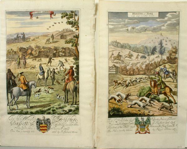
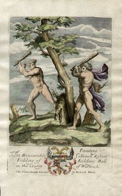
Tripti Joshi (Editor)

Richard Blome

Updated on
Edit
Like
Comment
Share on FacebookTweet on TwitterShare on LinkedInShare on Reddit
Name
  
Richard Blome

Died
  
1705

Books
  
Hawking: Or, Faulconry


Richard Blome

Richard Blome (1635-1705) was a publisher and cartographer from the Kingdom of England.

Contents

Richard Blome My friend has a few Richard Blome prints One is particularly

Overview

Richard Blome George Glazer Gallery Antique Prints Richard Blome Pugilist Prints

Richard Blome's cartography flourished in the second half of the seventeenth century. He produced a great amount of maps, but none were original, and he was often accused of plagiarism although usually made no attempt to hide his sources. His maps were attractive and quaintly designed, and they still retain their nostalgic look.

Blome's series of county maps were combined in the Britannia, based on the latest editions of mapmaker, John Speed, and was published in 1673 but was not a success. It was followed in 1681 by an issue of smaller maps entitled Speed's Maps Epitomiz'd. Most of his work was engraved by Wenceslaus Hollar, Richard Palmer, and Francis Lamb, and embellished with dedications to county dignitaries which were added or omitted in later editions.

Works

  • 1673 Britannia, or a Geographical Description of the Kingdom of England, Scotland and Ireland (average size 315 x 280 mm)
  • 1681 Speed's Maps Epitomiz'd (average size 180 x 230 mm) 1685 Re-issued 1693 Re-issued in Cosmography and Geography 1715 Re-published by Thomas Taylor in England Exactly described c. 1750 Re-issued by Thomas Bakewell (1716–64)
  • 1682 Cosmography and Geography (by Bernhard Varen) 1683-93 Re-issued
  • 1687 Isles and Territories of America for Anthony Earl of Shaftesbury<http://digitalarchive.mcmaster.ca/islandora/object/macrepo%3A21764> 1688 French edition
  • References

    Richard Blome Wikipedia