
Airport type Public Elevation AMSL 357 ft / 109 m 5,008 1,526 Phone +1 205-932-5367 | Owner City of Fayette 18/36 5,008 1,526 Asphalt Elevation 109 m Serves Fayette | |
 | ||
Similar Fayette City Hall, Richard Arthur Field‑M95, Guthrie Smith Park, City‑Faye Park & Recreation, Fayette Aquatic Center | ||
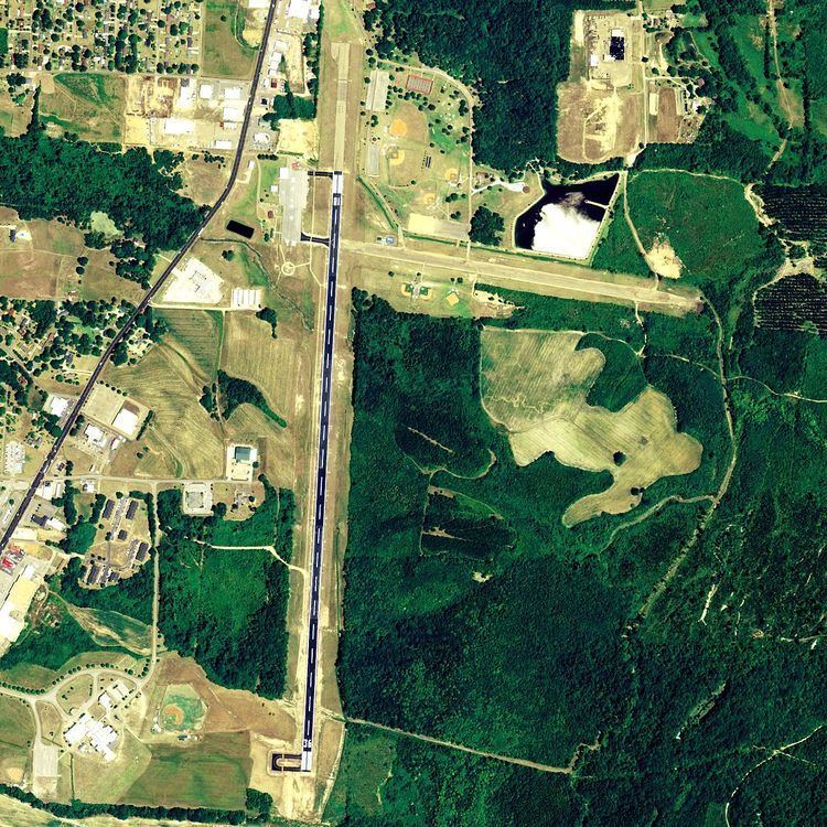
Richard Arthur Field (FAA LID: M95) is a city-owned public-use airport located three nautical miles (4 mi, 6 km) northeast of the central business district of Fayette, a city in Fayette County, Alabama, United States.
This airport is included in the FAA's National Plan of Integrated Airport Systems for 2011–2015 and 2009–2013, both of which categorized it as a general aviation facility.
Facilities and aircraft
Richard Arthur Field covers an area of 150 acres (61 ha) at an elevation of 357 feet (109 m) above mean sea level. It has one runway designated 18/36 with an asphalt surface measuring 5,008 by 80 feet (1,526 x 24 m).
For the 12-month period ending October 1, 2010, the airport had 15,300 general aviation aircraft operations, an average of 41 per day. At that time there were 8 aircraft based at this airport, all single-engine.