
- elevation 0 m (0 ft) Local time Wednesday 5:22 PM | - location Rua do Visconde, 56 Area 65.41 km² Team FC Ultramarina | |
 | ||
Weather 22°C, Wind SW at 6 km/h, 65% Humidity | ||
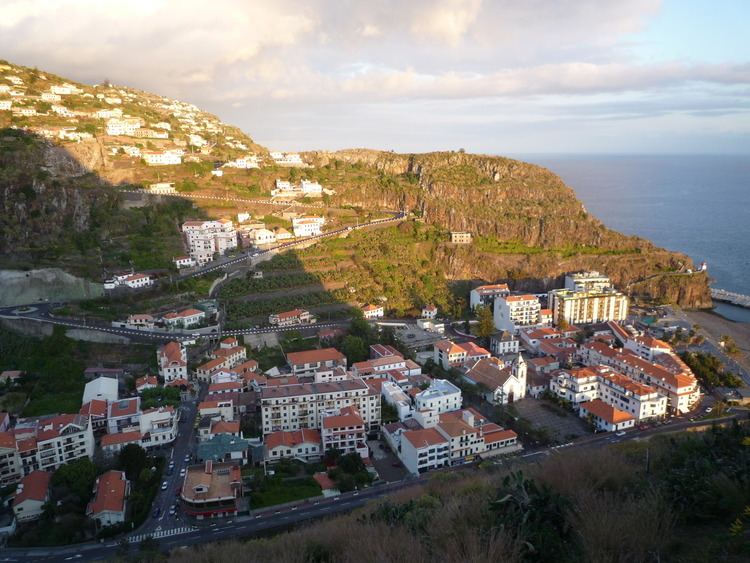
Ribeira Brava ([ʁiˈβɐjɾɐ ˈβɾavɐ]) is a municipality on the island of Madeira, in the Portuguese Autonomous Region of Madeira. It is located along the southern coast (approximately centre), and is west of Câmara de Lobos and the regional capital Funchal, south of São Vicente, and east of Ponta do Sol. The population in 2011 was 13,375, in an area of 65.41 km².
Contents
Map of Ribeira Brava, Portugal
The municipality gained its name due to its river - Ribeira Brava, which translates as 'the angry river'. In rainy seasons, the river had an extremely strong and powerful current, that often wreaked havoc over the entire eight kilometres of the route.
Geography
The municipality's namesake, the Ribeira Brava ravine and river valley extends from the slopes of the west-central mountains of Madeira. Its waters provide the primary sources of drinking-water (a small reservoir collects surface run-off) to the area and electricity to the island of Madeira. Approximately ten tributaries feed this river, whose course ends in the Serra de Água and which much later empties into the Atlantic along the village's coast.
The primary urban agglomerations are the four civil parishes, constituted with their own local government. They include:
Buildings and structures
The Centro Desportivo da Madeira stadium is located in the municipality.