
Width 5.6 km (3.48 mi) Highest point Bjørnkletten Elevation 336 m | Length 10 km (6 mi) Highest elevation 336 m (1,102 ft) County Hordaland Area 37.2 km² | |
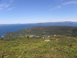 | ||
Reksteren is an island in the municipality of Tysnes in Hordaland county, Norway. The island covers an area of 37.2 square kilometres (14.4 sq mi). Its highest point is the 336-metre (1,102 ft) tall Bjørnkletten. The island lies northwest of the larger island of Tysnesøy. The small Bårdsundet strait separates the two islands and there is a road bridge connecting the two islands. The Langenuen strait runs along the west side of the island and the Bjørnafjorden lies along the north side of the island. The village of Gjøvåg lies along the western coast of the island and Reksteren Church is located along the eastern shore.
Map of Reksteren, 5683 Reksteren, Norway
References
Reksteren Wikipedia(Text) CC BY-SA