
Population 10,657 (2011 census) | Postcode(s) 4118 State electorate(s) Logan Postal code 4118 | |
 | ||
Location 25 km (16 mi) from Brisbane GPO | ||
Regents Park is a suburb of Logan City, immediately south of Brisbane in Queensland, Australia. The suburb is approximately 5 km² (476 hectares) in area, 12% of which is taken up by five parks. In the 2011 census, Regents Park had a population of 10,657 people.
Contents
- Map of Regents Park QLD 4118 Australia
- Demographics
- History
- Education
- Libraries
- Weekend Markets
- References
Map of Regents Park QLD 4118, Australia
Demographics
In the 2011 census, Regents Park had a population of 10,657 people; the population was 50.5% female and 49.5% male. The median age of the Regents Park population was 30 years, 7 years below the Australian average. Children aged under 15 years made up 25.3% of the population and people aged 65 years and over made up 6.0% of the population. 67.1% of people living in Regents Park were born in Australia, similar to the national average of 69.8%. The other top responses for country of birth were New Zealand 9.2%, England 3.6%, Philippines 1.5%, Bosnia and Herzegovina 0.9%, South Africa 0.6%. 80.2% of people spoke only English at home; the next most popular languages were 1.3% Samoan, 1.2% Serbian, 1.2% Spanish, 0.8% Mandarin, 0.7% Croatian. The most common response for religious affiliation was No Religion 24.9%, followed by Catholic 23.1%, Anglican 15.8%, Uniting Church 5.0% and Presbyterian and Reformed 3.1%. The great majority of households (84.9%) were family households, 12.3% were single person households and 2.8% were group households. The average household size was 3.1 people. Median mortgage repayments in Regents Park were $1,820, which is similar to the national median of $1,800.
History
Regents Park was originally part of Browns Plains. It was subdivided for residential housing in the early 1980s. The name Regents Park was proposed by the land developer.
Yugumbir State School opened on 28 January 1986. Regents Park State School opened on 1 January 1994.
Education
There are three schools in Regents Park:
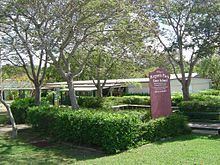
Libraries
Logan West Library is located in Grand Plaza Drive, Browns Plains near Grand Plaza. Other Logan City Council libraries not far away are in Greenbank and Marsden. Visit the LCC Library Page for more information.
Weekend Markets
There are three weekend markets near Regents Park:
A traditional multicultural fresh produce street market, easily accessible by train