
OS grid reference NY137338 Post town COCKERMOUTH Dialling code 01900 | Sovereign state United Kingdom Postcode district CA13 | |
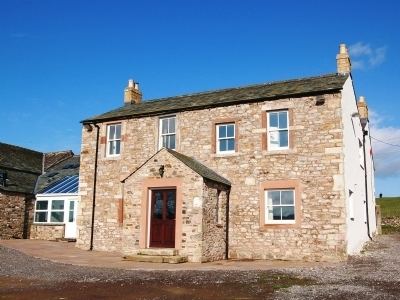 | ||
Redmain is a small hamlet in the Isel Valley and parish of Blindcrake within the Lake District National Park in Cumbria. The hamlet lies on the south-facing slopes above the River Derwent, in an elevated position of 475 feet (145 m), giving panoramas across the Isel Valley and Lake District Fells. Nearby are the hamlets of Isel and Sunderland and the village of Blindcrake.
Map of Redmain, Cockermouth, UK
The hamlet is just under four miles north-east of Cockermouth, off the old Roman road to Carlisle (A595). It is 12 miles from Keswick and, along the A66, it is 29 miles from the M6 motorway at Penrith.
References
Redmain, Cumbria Wikipedia(Text) CC BY-SA