
OS grid reference NY158338 Post town COCKERMOUTH Local time Wednesday 11:34 PM | Sovereign state United Kingdom Postcode district CA13 | |
 | ||
Weather 8°C, Wind S at 21 km/h, 89% Humidity | ||
Isel is a dispersed settlement,and area in the valley of the River Derwent within the Lake District National Park in Cumbria. It is an ecclesiastical parish within the civil parish of Blindcrake. Nearby are the hamlets of Sunderland and Redmain, and the village of Blindcrake.
Map of Isel, Cockermouth, UK
Isel is a rural community, with a church, a manorial Hall and several farms ranging from dairy to poultry, but lacking basic local facilities having no shop, public house or post office. It is mentioned in the English folk song "Horn of the Hunter."
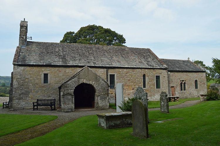
Isel Parish Church is dedicated to St Michael and the fabric is chiefly Norman. The church contains two pre-Norman carved stones, one of which is a fragment of a cross. Other buildings of interest are the old hall (with a pele tower), the ancient bridge of three arches (rebuilt in 1812) and the old vicarage.