
Length 45 km Source Forest Wierzchucińska | Basin size 485 km (187 sq mi) Mouth Bay of Puck | |
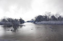 | ||
The Reda is a river in northern Poland in the Pomeranian Voivodship. It empties into the Bay of Puck, a part of Gdańsk Bay.
Contents
Map of Reda, Poland
The Reda is 45 km long, and drains about 485 square kilometers. It flows within the geographical region of Pobrzeże Kaszubskie; bordering Puszcza Darżlubska (English: Darżlubie Forest, or Darżlubska Wilderness) to the north, and the Tricity Landscape Park (Trójmiejski Park Krajobrazowy) to the south.
Flow of the Reda river
The Reda flows through or near these locations:
Gallery
References
Reda (river) Wikipedia(Text) CC BY-SA