
Length 24.5 km (15.22 mi) Area 18 km² | Width 5 km (3.1 mi) Administrative subdivision Tuamotus | |
 | ||
Island groups Tuamotu-Gambier Islands, Tuamotus | ||
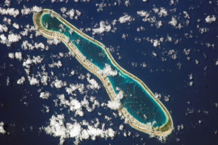
Reao or Natūpe is an atoll in the eastern expanses of the Tuamotu group in French Polynesia. The closest land is Pukarua Atoll, located 48 km to the WNW.
Contents
Map of Reao
Reao is 24.5 km long and its maximum width is 5 km. The whole length of its north-eastern rim is occupied by a single long island. There is no navigable pass into the lagoon.
Reao Atoll's population is 379 inhabitants.
History
The first recorded European to sight Reao Atoll was French explorer Louis Isidore Duperrey in 1823. He named this atoll "Clermont Tonnerre".
Reao was visited by the United States Exploring Expedition led by Charles Wilkes on August 13, 1839. Wilkes called this atoll "Minerva".
Reao Airport was inaugurated in 1979.
Flora and Fauna
The lagoon of the atoll is particularly important in that it hosts large colonies of Porites mordax and Acropora formosa corals, as well as over 400 Tridacna maxima clams.
Administration
The commune of Reao consists of Reao, as well as the atoll of Pukarua.