
Country India District Ernakulam PIN 683545 Population 27,537 (2011) Nearest city Perumbavoor | State Kerala Time zone IST (UTC+5:30) Vehicle registration KL- Local time Saturday 3:54 PM | |
 | ||
Weather 34°C, Wind W at 23 km/h, 52% Humidity | ||
.
Map of Rayamangalam, Kerala
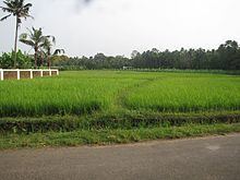
Rayamangalam is a village (Grama punchyathu) in the Ernakulam district of Kerala state, India.
Contents
- Map of Rayamangalam Kerala
- Location
- Economy
- Transportation
- Kunnathnadu Tehsil
- Landmarks
- Population
- References
Location
Rayamangalam is close to the towns Kuruppampady, Perumbavoor, Muvattupuzha and Kothamangalam.
Economy
Rayamangalam have a number of rock mining quarries and stone crushers. The surrounding hills are either planted with latex trees, or are being quarried. Another major activity is wood processing to produce plywood, matchsticks and other products. The Punchayath office is located at Nellimolam, on the Keezhillam- Kurichilakkodu road from Aluva Munnar Road (AM road).
Transportation
The main roads passes through this punchayath are MC road and Aluva - Munnar (AM road). A canal, part of the Periyar Valley Irrigation Project, origiunate from the Periyar River at Boothankettu passes through the heart of the village. The Koottumadam Temple here is known for the Thaipooyam festival of Subrahmanyan, along with the nearby Temple of Siva Perakkattu. In terms of health care there are two hospitals, and one Primary Health Center at Nellimolam.
Kunnathnadu Tehsil
This village is part of Kunnathnadu taluk of Ernakulam district. Other towns in this area include Kizhakkambalam, Kombanad, Mazhuvannoor, Rayamangalam and thiruvaniyoor.
Landmarks
Population
According to the 2011 census of India, Rayamangalam has 6947 households. The literacy rate of the village is 88.34%.