
Postcode(s) 6434 Elevation 183 m Local time Saturday 5:03 PM | Postal code 6434 | |
 | ||
Location 910 km (565 mi) east of Perth350 km (217 mi) east of Kambalda Weather 23°C, Wind E at 21 km/h, 84% Humidity Lga City of Kalgoorlie-Boulder | ||
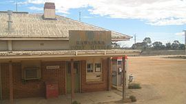
Rawlinna is a remote locality and railway siding on the Trans-Australian Railway in Western Australia. It is also the site of a small lime mine, in which the lime is extracted from the limestone that is prevalent in the area. The lime is mostly used in the gold production process at Kalgoorlie.
Map of Rawlinna WA 6434, Australia
Rawlinna is also the start of the Connie Sue Highway, an outback track that leads to Warburton.
There is no fuel for sale at Rawlinna. The closest locations are Caiguna and Cocklebiddy on the Eyre Highway, more than 100 km to the south.
The Great Southern Rail train, the Indian Pacific, which runs between Sydney and Perth, calls at the siding twice a week in each direction. Passengers can alight or disembark on request.
During the time of the Trans-Australian Railway requiring personnel at railway stations the community at Rawlinna supported a school.
The 1,000,000-hectare (2.5-million-acre) sheep station, Rawlinna Station, is bordered by the railway line.
Notable derailments of Nullarbor crossing trains near or at Rawlinna have occurred in 1930, 1955, 1975, December 2015, and April 2016.
Some of the derailments are attributed to washaways; the 1931 and 1955 reports allude to the main cause being damage from water.