
Time zone WET (UTC+0) Elevation 76 m Local time Saturday 3:07 AM | Irish Grid Reference N833483 Population 168 (2006) | |
 | ||
Weather 0°C, Wind N at 6 km/h, 99% Humidity | ||
Rathmolyon /ræθmɒˈlaɪn/, rath-muu-LEYEN, Irish: Ráth Máigh Laighin, meaning "ringfort of the Leinster Plain") is a village in the southern portion of County Meath, Ireland, situated 8 km south of Trim. It is situated at the junction of the R156 regional road and the R159 regional road connecting Trim to Enfield. Rathmolyon serves as a service center for the surrounding rural area.
Contents
Map of Rathmolyon, Co. Meath, Ireland
Public transport
Bus Éireann route 115A provides a commuter link from Rathmolyon to Dublin via Summerhill and [Dunboyne] with one journey in the morning and an evening journey back every day except Sunday. Until 24 August 2013 (incluive) Bus Éireann route 118 provided a daily commuter service from to/from Dublin via Dunboyne and a daily service to/from Mullingar.
Local history
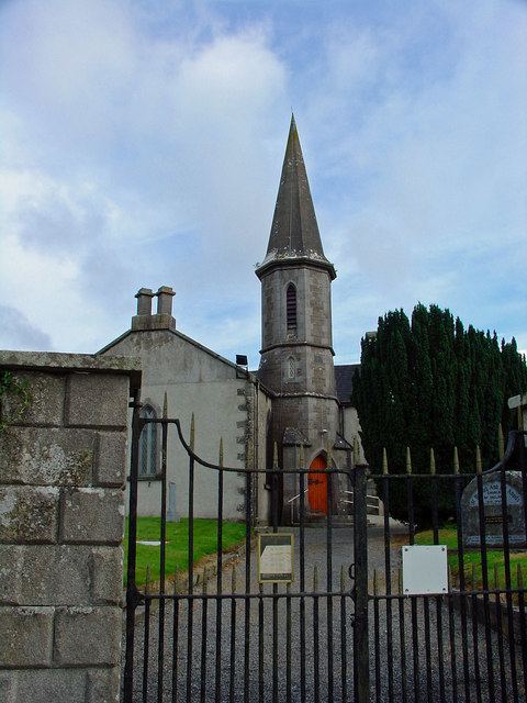
The village developed at the junction of two regional roads. Most of the significant older buildings in the village date from the Georgian and Victorian periods. During the late 19th century, the area played an important role in the development of the Two by Twos and Cooneyite movement, the only religion known to have had its origin in Ireland.
Although small, Rathmolyon includes some impressive buildings, which include a Catholic church, a Protestant church, two public houses, Cherryvalley House, Rathmoylon Villa and Rathmoylon House.
Local attractions
The "Rathmolyon Esker" east of Rathmolyon has been proposed as a Natural Heritage Area.