
Country Thailand Time zone THA (UTC+7) Geocode 9007 Population 67,551 (2008) | Seat Ranot Postal code 90140 Area 783.8 km² Province Songkhla Province | |
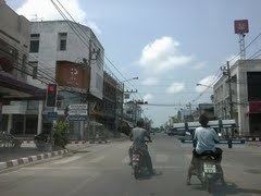 | ||
Ranot (Thai: ระโนด) is the northernmost district (Amphoe) of Songkhla Province, southern Thailand.
Contents
Map of Ranot District, Songkhla, Thailand
Geography
Neighboring districts are (from the south clockwise) Sathing Phra, Krasae Sin of Songkhla Province, Mueang Phatthalung, Khuan Khanun of Phatthalung Province, Cha-uat and Hua Sai of Nakhon Si Thammarat Province. To the east is the Gulf of Thailand.
The western part of the district is at the shore of the Thale Noi, the northern part of the Songkhla Lake.
Etymology
The name Ranot is actually the Thai corruption of Renut (Jawi: رينوت), its original name in Malay. However, many local residents maintain that it is a shortened form of the Thai words ราวโตนด (Rao Tanot: a row of palm trees). The official English-language spelling Ranot is falling out of favor locally, with the more phonetically accurate spelling 'Ranode' being used in its place.
Administration
The district is subdivided into 12 subdistricts (tambon), which are further subdivided into 73 villages (muban). There are two subdistrict municipalities (thesaban tambon) - Ranot covers parts of tambon Ranot, and Bo Tru covers parts of tambon Bo Tru, Ra Wa and Wat Son. There are further 12 Tambon administrative organizations (TAO).