
Country Thailand Time zone ICT (UTC+7) Area 3,298 km² Area rank Provinces of Thailand | Capital Ranong ISO 3166 code TH-85 Population 177,089 (2014) | |
 | ||
Points of interest Rattanarangsan Palace, Punyaban Waterfall, Ranong Canyon, Kra Isthmus, Mu Ko Ranong National Destinations Si Phang‑nga National, Ngao Waterfall National, Bang Rin, Ngao, Ko Phayam | ||
Hot spring ranong province
Ranong (Thai: ระนอง, [ra.nɔːŋ] or [rá.nɔːŋ]) is one of Thailand's southern provinces (changwat), on the west coast along the Andaman Sea. It has the fewest inhabitants of all Thai provinces. Neighboring Ranong are (clockwise) Chumphon, Surat Thani and Phang Nga. To the west, it borders Kawthaung, Tanintharyi, Myanmar.
Contents
- Hot spring ranong province
- Map of Ranong Thailand
- Channel 7 unseen thailand ranong province thailand 04 2016
- Geography
- History
- Symbols
- Administrative divisions
- Sights
- Festivals
- References
Map of Ranong, Thailand
Channel 7 unseen thailand ranong province thailand 04 2016
Geography
Ranong is on the Kra Isthmus, a narrow strip of land that connects Thailand with the Malay Peninsula, on the west of the Phuket mountain range. It has a long coast on the Andaman Sea. The province, together with Trat Province, is known for being one of the wettest places in Thailand, the rainy season lasting for about eight months.
Ranong is the least populated province. Eighty percent of its area is covered by forests, and 67% is mountainous. In former years the major industry was tin mining, but most mines are now exhausted. White clay mining (for the production of porcelain) and fishing are now the main industries, along with rubber and cashew nuts.
The Ranong Biosphere Reserve in the north of Amphoe Kapoe, covering 303.09 km², was declared in 1997. It is the fourth biosphere reserve of Thailand, and the only one at the seacoast to protect the mangrove forests. Khlong Nakha Wildlife Sanctuary is in the south of the province.
History
The name Ranong is a Thai corruption of Rundung, (Jawi: روندوڠ), a sparsely populated former Malay principality once under the Malay Sultanate of Kedah. Rundung gradually submitted to Thai rule after repeated Thai invasions during the Ayutthaya period centuries ago.
Today, Ranong Province is an entrepôt in the trafficking of Rohingya people from nearby Burma (Myanmar).
Symbols
The provincial seal shows a castle on top of a hill, as an aide memoire that King Chulalongkorn (Rama V) once visited Ranong and stayed at the Ratana Rangsan Castle on top of the Niveskiri Hill. The number five refers to King Rama V; the castle is Ratana Rangsan Palace; the mountain is Niveshkiri; the royal tray refers to the people of Ranong.
The provincial slogan is, "Kra Isthmus, mountain grass, cashew nut, mineral water stream, and real pearl of Ranong."
The provincial tree is the Banaba (Lagerstroemia speciosa), and the provincial flower is the orchid Dendrobium formosum.
Administrative divisions
Ranong is subdivided into five districts (amphoe). These are further subdivided into 30 subdistricts (tambon) and 167 villages (muban). Ranong itself is the only town (thesaban mueang), and there are five more subdistrict municipalities (thesaban tambon).
Sights
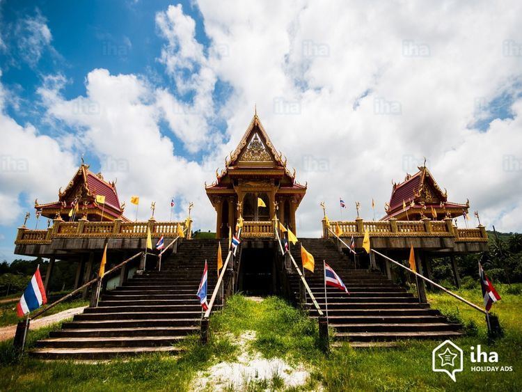
Rattanarangsarn Palace (พระราชวังรัตนรังสรรค์ จำลอง ) Phraya Damrong sutjarit Mahitsornpakdee (Kor Sim Kong) built this throne hall for the residence of King Rama V during the royal visit to Ranong Province on 23–25 April 1890. It is on the hilltop named "Niwest Kiree". The original throne hall was later dismantled and replaced by the city hall and then the new provincial hall was built in 2002. It was made of teak wood.
Ranong Governor's Grave (สุสานเจ้าเมืองระนอง) This Chinese grave of Phraya Rattanasetthi (Kho Su Chiang), Ranong's first governor, is on a piece of land dedicated by King Rama V. There are three tiers of stone platform with steps leading up to the grave with antique granite sculptures of Chinese noblemen, horses, goats, and lions on both sides.
Hot Springs and Raksawarin Public Park (บ่อน้ำร้อนและสวนสาธารณะรักษะวาริน) The hot springs have been a popular tourist spot ever since King Rama V visited Ranong in 1890. There are three natural spring pools. The temperature of the water in the pools remains constant at about 65 °C.
Wat Hat Som Paen (วัดหาดส้มแป้น) This temple is on Khlong Hat Som Paen and provides a sanctuary for a shoal of soro brook carp.
Wat suwan Khiri (วัดหน้าเมือง) It contains a Burmese style chedi, over 70 years old and 10 metres in height, which was built by a Burmese, a main ordination hall, or phra ubosot where a beautifully bejewelled standing Buddha image is enshrined and a belfry decorated with a feline pattern.
Namtok Punyaban (น้ำตกปุญญบาล) Formerly known as Namtok Set Takuat, this 20-metre high waterfall is at km597 on Highway 4 towards Chumphon.
Namtok Ton Phet (น้ำตกโตนเพชร) Surrounded by moist evergreen forest with Ranong's highest Phota Chong Dong Mountains being the source of water, each tier of the falls cascades down boulders all year round.
Phukhao Ya (Grass Hill) or Khao Hua Lan (Bald Hill) (ภูเขาหญ้าหรือเขาหัวล้าน) Known to locals by a variety of names and endearingly referred to as Thailand's version of a Swiss pasture, this hill is something of an anomaly as it is completely treeless, being covered instead by a thick blanket of grass.
Namtok Ngao National Park (อุทยานแห่งชาติน้ำตกหงาว) Covering a total area of approximately 417,500 rai (668 km2) it was declared a national park on 3 June 1999.
Ngao Mangrove Forest Research Centre (ศูนย์วิจัยป่าชายเลนหงาว) has been declared a World Biosphere Reserve Zone by UNESCO owing to the essential role this mangrove plays in maintaining the region's ecological integrity. Many species of marine life come to the mangrove to mate, incubate their eggs, and care for their young.
Hat Chan Damri (หาดชาญดำริ) This small beach and pier, and a nearby hillside viewpoint offer good vantage points from which to witness seafaring life along the mouth of Ranong's principal river.
Victoria Point or Ko Song (วิคตอเรียพอยท์ หรือ เกาะสอง) An island in neighbouring Myanmar
Ko Chang (เกาะช้าง) With an area of 18 square kilometres and 80 homes on the entire island. Cashew and para rubber plantations as well as coastal fisheries are the main industries.
Ko Phayam (เกาะพยาม) is known for both its long fine white sandy beaches and for the cashew nuts which are grown on the island. A number of sea gypsies, or Chao Le, live on the island.
Mangrove Arboretum (สวนรุกขชาติป่าชายเลน) In Pa Khlong Lamliang-La-un National Reserve area and reforested under the Khlong La-un Mangrove project. Two years later, it was developed into a mangrove arboretum with a 1,500-metre long boardwalk being constructed.
Royal Initial Stones (ศิลาสลักพระปรมาภิไธย) There is an area where the royal initials of King Rama V were inscribed onto a stone to mark his royal visit. There are also inscriptions of King Bhumibol Adulyadej and Queen Sirikit as well as Princess Maha Chakri Sirindhorn's initials.
Kho Khot Kra or Kra Isthmus (คอคอดกระ หรือ กิ่วกระ) The Kra Isthmus is the Malay Peninsula's narrowest point, spanning a mere 44 kilometres from the Gulf of Thailand to the Andaman Sea. The Kra Isthmus provides an excellent vantage point from which to see the Kraburi River forming a natural boundary between Thailand and Myanmar.
Tham Phra Khayang (ถ้ำพระขยางค์) Despite its small scale, this cave is related to a legend of the establishment of the district. Some 40 metres deep inside, a staircase leads upward and further outside the cave to where some rare herbs are believed to have been grown.
Namtok Chum Saeng or Namtok Sai Rung (น้ำตกชุมแสงหรือน้ำตกสายรุ้ง) In the rainy season, a lot of water cascades down the boulders creating rainbows in the mist. This is why it is called "Namtok Sai Rung" or "Rainbow Waterfall".
Namtok Bok Krai (น้ำตกบกกราย) At the end of the road, a 20-metre walk through farmland and a moist forest will lead to this enormous waterfall that runs throughout the year.
Khlong Nakha Wildlife Reserve (เขตรักษาพันธุ์สัตว์ป่าคลองนาคา) This wildlife reserve houses a breathtaking waterfall known as Namtok Phan Met (น้ำตกพันเมตร) amid a stretch of verdant forest.
Laem Son National Park (อุทยานแห่งชาติแหลมสน) It covers a total area of 196,875 rai (31.5 hectares). It also includes islands in the Andaman Sea; namely, Ko Khangkhao and Mu Ko Kam. Places of interest within the national park include:
Khao Fa Chi (เขาฝาชี) The hill provides an excellent vantage from which to see two rivers, the Kraburi and the La-un, converge. Japanese soldiers used this area as a port, sending support to Burma during the Second World War.
Japanese Shipwreck (ซากเรือรบญี่ปุ่น) Approximately two kilometres beyond Chao Fa Chi, a wreck of a Japanese freighter used in World War II between a pier in Tambon Pak Chan, Amphoe Kraburi and Burma is visible at low tide.
Festivals
Visit Ranong and Andaman Fair (งานเปิดเมืองระนองท่องอันดามัน) Held in March, the Fair features exhibitions by various organizations, booth displays of travel agencies and folk sports activities.
Image Boat Procession and Races (งานเสด็จพระแข่งเรือ อำเภอกระบุรี) Held cooperatively by Thai and Burmese people during the first three days of the waning moon of the eleventh lunar month, the event features a Buddha image boat competition. Boats will be decorated to carry Buddha images and will float in procession along the Kra Buri River, near the Kra Isthmus, passing by riverside communities. There will be a boat song contest and boat races as well as other forms of entertainment in front of the Kra Buri District Office.