
Population 299 (2011 census) Local time Saturday 3:56 AM | Postcode(s) 2669 Postal code 2669 | |
 | ||
Weather 21°C, Wind NE at 21 km/h, 72% Humidity | ||
Rankins springs stage intruder
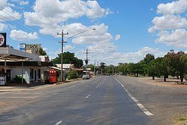
Rankins Springs is a small town in the Riverina region of New South Wales, Australia in Carrathool Shire and on the Mid-Western Highway. At the census, Rankins Springs had a population of 299. The settlement of Rankins Springs is strung out along the Mid-Western Highway and adjacent railway line.
Contents
- Rankins springs stage intruder
- Map of Rankins Springs NSW 2669 Australia
- Rankins springs is west official copy
- History
- References
Map of Rankins Springs NSW 2669, Australia
Rankins springs is west official copy
History
The site of the original township was 10 km north-west of its current location along the Hillston Road. Rankins Springs was established in 1869 around the springs at the foot of the Conapaira Range (from which the township was named). Rankins Springs Post Office opened on 1 September 1875.
References state "the springs were closed in 1957". Nowadays the springs only appear after extensive heavy rain.
The railway reached Rankins Springs in 1923. Passenger service was halted in 1974, and grain freight service was halted in 2004.
The main agricultural activities of the district around Rankins Springs are the growing of crops such as wheat and oats, and beef-cattle and wool-production.