
Country India | State Karnataka | |
 | ||
a
Map of Ramakrishnanagar, Mysuru, Karnataka
Rama Krishna Nagar is a residential locality in southern Mysuru. The nucleus of the area is called the 'Rama Krishna Circle' or the Andolana intersection. This area is very near to Kuvempunagar and Vivekananda nagar.
Contents
- Map of Ramakrishnanagar Mysuru Karnataka
- Church Bus stop
- Lingambudhi Park
- Andoloana Circle
- Landmarks
- References
Church Bus-stop
One of the bus stops at Ramakrishna Nagar is also known as 'the Church stop' because there is a CSI Church on the bus stop. This location is also called E and F Block. The road further goes up to the last stop of KSRTC which is otherwise called 'H' Block. Lingambudhi Lake is at a walking distance from E-Block.
Lingambudhi Park
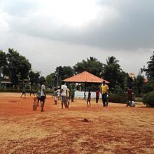
The biggest attraction of Ramakrishna Nagar is the Lingambudhi Park. It is a sprawling bamboo forest with two kilometer perimeter walking track near the Lingambudhi Lake. This lake is rich in the diversity of flora and fauna. The lake was constructed in 1828 and continues to have a rural charm in the middle of the city. In addition to the park, there is an embankment on the lake which is suitable for walking and jogging. The road around the lake connects Rabindranath Tagore Layout with Srirampura bus stop.
Andoloana Circle
The epicenter of Ramakrishna Nagar is the Andolana intersection which is now called Ramakrishna Nagara Vruttha. This intersection connects the Kuvempu Nagar main road with the Double Road and the Ring Road. One road from the intersection also connects to the University and Hunsur Road area.