
- elevation 256 ft (78.0 m) Phone +1 610-982-5560 | Area 18 ha Established 1931 | |
 | ||
Address 6011 State Park Rd, Pipersville, PA 18947, USA | ||
Ralph Stover State Park is a Pennsylvania state park on 45 acres (18 ha) in Plumstead and Tinicum Townships, Bucks County, Pennsylvania in the United States. It is a very popular destination for whitewater kayaking on Tohickon Creek and rock climbing on High Rocks (Triassic sandstone of the Newark Group). Ralph Stover State Park is two miles (3.2 km) north of Point Pleasant near Pennsylvania Route 32.
Contents
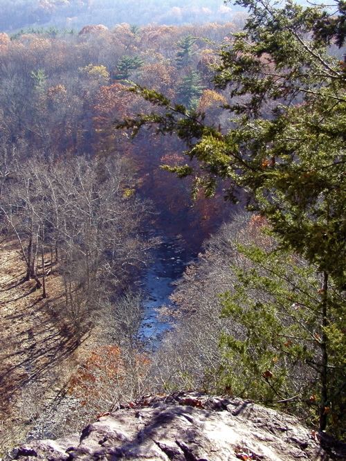
Ralph stover state park high rocks vista
HistoryEdit
Tohickon Creek was named by the Lenape some of the first inhabitants of the area. "To-Hick-Hanne" means "Deer-Bone-Creek". Ralph Stover State Park was the site of an 18th-century gristmill that was built on Tohickon Creek by the park's namesake, Ralph Stover. Remnants of the mill and mill race can still be seen near Tohickon Creek.
The Stover family gave their land to the Commonwealth of Pennsylvania in 1931. The recreational facilities were built during the Great Depression by the Federal Works Progress Administration created by U.S. President Franklin D. Roosevelt to provide work for the unemployed. Author James A. Michener donated the High Rocks area to the park in 1956. Although "High Rocks State Park" is listed in the United States Geological Survey Geographic Names Information System and the coordinates given in USGS GNIS are located here, it was never an official name according to the Pennsylvania Department of Conservation and Natural Resources or a separate park.
RecreationEdit
High Rocks is a 200-foot (60 m) sheer rock face, composed of smooth red Lockatong Formation argillite interspersed with friable Brunswick Formation shale. Since slippery and crumbly rock makes climbing somewhat difficult here, High Rocks is notable mostly to local climbers. Over sixty routes have been put up here over seventeen walls, with difficulties up to 5.12c/d and V7. Most are used for trad climbing and top roping, with some bouldering and sport routes present as well.
Tohickon Creek offers whitewater conditions for kayaking in the spring with the winter snow melt and several times a year when water is released from Lake Nockamixon. The creek is also a warm water fishery with smallmouth bass, sunfish, carp and catfish. The Pennsylvania Fish and Boat Commission also stocks the creek with trout.
A hiking trail of 1 mile (1.6 km) passes the millrace. There is a shaded picnic area along Tohickon Creek and a scenic vista at the top of High Rocks.
Nearby state parksEdit
The following state parks are within 30 miles (48 km) of Ralph Stover State Park: