
Territorial authority | Region Canterbury Local time Friday 11:41 AM | |
 | ||
Weather 15°C, Wind SE at 6 km/h, 74% Humidity | ||
Rakaia salmon river roadside stories
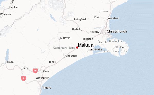
The town of Rakaia is seated close to the southern banks of the Rakaia River on the Canterbury Plains in New Zealand's South Island, approximately 57 km south of Christchurch on State Highway 1 and the Main South Line. Immediately north of the township are the country's longest road bridge and longest rail bridge, both of which cross the wide shingle beds of the braided river at this point. Both bridges are approximately 1750 metres in length.
Contents
- Rakaia salmon river roadside stories
- Map of Rakaia New Zealand
- Salmon fishing at the rakaia river mouth march 2015
- References
Map of Rakaia, New Zealand
Rakaia was also the junction of the Methven Branch, a branch line railway to Methven that operated from 1880 until its closure in 1976. An accident at the railway station in 1899 killed four people.
A township of under 1000 people, its most obvious feature is a large fibreglass salmon. The river from which the town takes its name is known for its salmon fishing and jetboating.