
Area 2.88 km² | Postal code 798 57 Elevation 434 m Population 110 (2006) | |
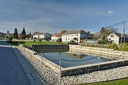 | ||
Rakůvka is a village and municipality (obec) in Prostějov District in the Olomouc Region of the Czech Republic.
Map of 798 57 Rak%C5%AFvka, Czechia
The municipality covers an area of 2.88 square kilometres (1.11 sq mi), and has a population of 110 (as at 3 July 2006).
Rakůvka lies approximately 20 kilometres (12 mi) north-west of Prostějov, 23 km (14 mi) west of Olomouc, and 189 km (117 mi) east of Prague.
References
Rakůvka Wikipedia(Text) CC BY-SA