
Country India Language spoken Hindi | State Rajasthan District Churu | |
Rajgarh (Rajasthani: ) is a town and tehsil in the Churu district of northern part of Rajasthan state in India.The railway station in Rajgarh is known as Sadulpur.To distinguish Rajgarh from places with similar names,Sadulpur has become a synonym of citys name in recent times. It is close to the Haryana border. Sadulpur railway junction lies on Bikaner-Churu-Delhi and Churu-Hisar railway routes.
Contents
- Map of Rajgarh Rajasthan
- Demographics
- Description
- Climate
- Transportation
- Schools and Colleges
- Computer Institutes
- The following banks have branches and ATMs in town
- Important places
- Notable people
- Geography
- Economy
- References
Map of Rajgarh (Rajasthan)
Demographics
As of the 2001 Indian census, Rajgarh town had a population of 48,057. Males constitute 52% of the population and females 48%. Rajgarh has an average literacy rate of 75%, higher than the national average of 59.5%.
Description
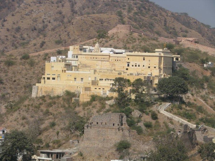
Rajgarh or Sadulpur is a town and tahsil in Churu district in Rajasthan. It was part of Jangladesh where Poonia Jats had ruled. It was founded by Poonia gotra jats. Rajgarh is the birthplace of Lakshmi Niwas Mittal, of Arcelor Mittal and Bimal Jalan, an economist and former Governor of Reserve Bank of India. There is an equal population of Hindus and Muslims in the city.the Great fort was built in 1766 by maharja Gaj singh bahadur on name of his son Raj singh ji bahadur of Bikaner. Most of Muslims were migrated from Narhar during construction of Fort.It was supervised by them, they had fought war with local tribes and defeated them .Local tribes were not in favor of construction of fort. Bikaner ruler was very happy with this brave victory .
Climate
The region has record temperatures ranging from below freezing point in the winter to over 50 °C in summer. The District of Churu is also the hottest zone in the country.
Transportation
Rajgarh is connected to Bikaner, Jaipur, Delhi and other cities by road. It is about 240 km from Delhi by NH-10 via Rohtak, Hisar (170 km), then needs to take NH-65 on Hisar-Jodhpur Road (70 km). Shorter route from Delhi is via Rohtak, Bhiwani, Bahal (around 210 km). The National Highway No-65 passing through Rajgarh via Dokwa, Dudhwa Khara, Churu, Fatehpur, Salasar etc. A bypass road attaches to NH65 to Taranagar, Bhadra, Hisar road. The National Highway No-709 Ext. also ending at Rajgarh.
Rajgarh is situated on the main Delhi-Bikaner, Hisar-Jodhpur and Sriganganagar-Jaipur rail link. The railway junction of Rajgarh town is known as Sadulpur named after Maharaja Sadul Singh of Bikaner. It takes around 3–4 hours from Delhi (en route you would cross major stations like Gurgaon, Rewari, Mahendragarh, Loharu). Till 2011 the route had metre gauge track that was converted to 1,676 mm (5 ft 6 in) broad gauge. Several new trains now connect Rajgarh and Sadulpur to major cities Delhi, Bikaner, Jaipur, Lucknow, Degana, Sri Ganganagar, Hisar, Hanumangarh and Pathankot.
The nearest airports are Delhi Airport and Jaipur Airport.
Member of Parliament: [Rahul Kaswan]
- member of legislative assembly is Manoj Singh Nyangali ( BSP )
- Panchayat Samiti: The Pradhan is Dharm Chand Godara.
- Jila Parmuk-Har Lal Saharan.
- Ex.MLAs are Inder Singh Poonia,Nand Lal Poonia, Smt. Kamala Kaswan,Deep Chand and Ram Singh Rao.
- Late Sh.Shish Ram Poonia was famous MLA in M.L.Sukhadias era.
- J.N.S.Poonia MLA Taranagar and Ex Minister belongs to Rajgarh.
- Late Sh Kumbha Ram Arya was first MLA of Rajgarh.
- Chairman of Rajgarh Municipality Sh. Jagdish Bairasaria
- Late Mohar Singh Poonia was two times MLA of communist party.
Schools and Colleges
Computer Institutes
The following banks have branches and ATMs in town
Important places
Notable people
Geography
Rajgarh is located at28.36°N 75.24°E? / 28.36; 75.24. Sadulpur railway station has elevation of 239 metres (784 ft).
Economy
The town has a market (mandi) for commodity trading. Trading of commodity products is always a hot business for the locals in the small town.