
- summer (DST) CEST (UTC+2) Area 31.46 km² Region kraj Žilina Region | Elevation 452 m Local time Thursday 9:56 PM | |
 | ||
Weather 9°C, Wind E at 5 km/h, 80% Humidity Points of interest Mestské múzeum Rajec, Pomník padlých v I svetovej v, Tabuľa Juraja Slotu na s | ||
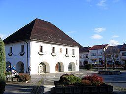
Rajec (-Slovak and Hungarian, German: Rajetz) is a town in the Žilina District, Žilina Region in northern Slovakia.
Contents
Map of 015 01 Rajec, Slovakia
Etymology
Rajec, Rajčianka, Rajčanka are derived from Proto-Slavic appelative *rajь – a wet, muddy place (modern Slovak raj – a paradise, "a place with rich vegetation").
History
The first written record about Rajec was in 1193 as Raich, in a document issued by King Béla III. The first mention as a town comes from 1397.
Geography
Rajec lies at an altitude of 452 metres (1,483 ft) above sea level and covers an area of 31.459 square kilometres (12.1 sq mi). It is situated between Strážovské vrchy and Malá Fatra mountains, in the Rajčanka river valley, around 20 km (12 mi) south-south-west of Žilina.
Demographics
According to the 2001 census, the town had 6,074 inhabitants. 98.86% of inhabitants were Slovaks and 0.68% Czechs. The religious make-up was 92.79% Roman Catholics, 3.42% people with no religious affiliation and 1.89% Lutherans.