Location Nebraska, USA Established 1963 | Nearest city Kearney | |
 | ||
Area 22,864 acres (92.53 km) Governing body U.S. Fish and Wildlife Service Website Rainwater Basin Wetland Management District Management United States Fish and Wildlife Service | ||
Du tv migration report nebraska s rainwater basin
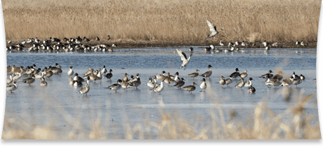
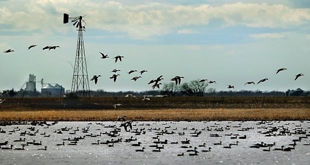
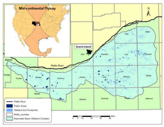
The Rainwater Basin is a 4,200 mi.2 (10,900 km2) region of shallow lakes, marshes and other wetlands located south of the Platte River in south-central Nebraska. In the spring and fall months, millions of migratory birds pass through the region to feed and rest. The Rainwater Basin, along with the Platte River, is a major component of the Central Flyway of North America. These oval basins occur south of the Platte River on the loess-covered landscape of Nebraska.
Contents
- Du tv migration report nebraska s rainwater basin
- Frog irruption at rainwater basin wetland
- Rainwater Basin Wetland Management DistrictEdit
- Birds of the Rainwater BasinEdit
- ConservationEdit
- References
This area is often referred to as "God's Country" by residents.
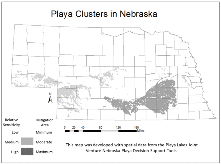
The Rainwater Basin contains numerous oriented, typical oval depressions that contain ecologically important wetlands and lakes. These depressions are the surface expression of elliptical depressions developed in fluvial sands and gravels that are buried by a blanket of a 2.5–8 meters (8.2–26.2 ft) thick sequence of layered loesses and associated paleosols. The loess, which overlies these features, consists of an undisturbed sequence, from bottom to top, of Middle Wisconsinan Gilman Canyon Formation (loess), a regional paleosol developed in Gilman Canyon Formation, Late Wisconsinan Peoria Loess, Brady Soil (paleosol) developed in the Peoria Loess, and Holocene Bignell Loess in which the modern soil has developed. This loess sequence lies upon a paleosol developed in the fluvial sands and gravels in which these depressions initially developed. Thus, the modern basin landscape is a direct result of the accumulation a few meters of loess that blankets an older basin landscape. These basins are palimpsest landforms created by the episodic accumulation of a blanket of loess over a prehistoric landscape with numerous basins. The overlying sequence of loesses and associated paleosols demonstrate that the basins were formed prior to the Early Wisconsinan accumulation of the Gilman Canyon Formation.
Frog irruption at rainwater basin wetland
Rainwater Basin Wetland Management DistrictEdit
The Rainwater Basin Wetland Management District (WMD) currently manages 61 tracts of land, 59 of which are Waterfowl Production Areas (WPA) totaling 22,864 acres (92,52 km2) in the U.S. state of Nebraska. One of the remaining two areas is McMurtrey Wildlife Management Area that was transferred from the U.S. Military and is closed to public use. The other tract is the Platte River National Wildlife Management Area and this property is owned by the state of Wyoming and managed through a memorandum of understanding. WPAs are small isolated tracts of land scattered throughout the District. The Wetland Management District is managed from offices in Kearney, Nebraska. All of the federally managed land was acquired from willing landowners and purchased with the proceeds of duck stamps that are sold to hunters each year.
Birds of the Rainwater BasinEdit
The Rainwater Basin is a prime location for birdwatching; 257 bird species have been observed in the region.[1] Species in the Rainwater Basin include:
ConservationEdit
Before the large-scale settlement of Nebraska in the late 19th century, there were 4,000 individual wetlands, covering 100,000 acres (40,000 ha), in the region. Since that time, about 90% have those wetlands have disappeared, with many being drained so that the land could be used for agricultural purposes. Many of the remaining sites have been set aside by government agencies and non-profit organizations; today, there are 84 publicly owned Rainwater Basin sites, totaling 28,600 acres (11,600 ha).