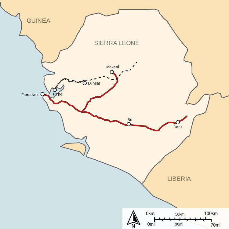
Railway stations in Sierra Leone include:
The MSN and FallingRain and UNHCR maps still show the railway lines closed in 1974.
UN Map of Sierra Leone - no railways shown at all.UNHCR Atlas mapMap on page 24.African Mineral iron ore railway Map(private 1,067 mm (3 ft 6 in) line) (upgraded to 20Mtpa)(renewed line to be open access) Port Pepel - low capacity portMadinaLungi LolMakoatoBankasoka River bridgePort LokoLunsar - terminus at mineMarampa - iron ore mine.MakeniBumbunaTonkolili - proposed extension to iron ore deposit (new parallel 1,435 mm (4 ft 8 1⁄2 in) gauge line)(capacity 50Mtpa)(new line to be open access) Tagrin Point proposed high capacity portMarampa - iron ore mine.MakeniBumbunaTonkolili - proposed extension to iron ore deposit Kasafoni - proposed iron ore mineTonkolili - iron ore mineSulima southern port at the mouth of the Moa River.(government 762 mm (2 ft 6 in) line)
Freetown in 1896.Wellington (7 miles) by March 1897.Waterloo April 1898Songo (32 miles/51.5 km) 1899Bradford - way stationRotifunk (56 miles/90.1 km) 1900Bauya - junctionMoyambaManoBo (103 miles/165.8 km) 1903GerihunBlamaBaiima (145m) (220 miles/354 km) 1905Pendembu (227.5 miles/366 km) 1907KenemaDaru - terminusBauya - junctionMagburaka - branchMakeni - branch terminusBagla Hills - iron ore September 2008 - dispute over mining leases hampers rehabilitation of Marampa railway.While the Port Pepel line is non-operational, much theft of the rail and sleepers is taking place. The only advantage of this is to make conversion to standard gauge more easy.

