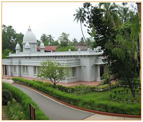
Town/Locality Kolkata Telephone code +91 33 Elevation 12 m | Time zone IST (UTC+5:30) | |
 | ||
Rahara is a small urban area located in the northern neighborhood of Kolkata in West Bengal in the Indian state of West Bengal. It is a part of the Khardaha municipal area, and is under the Khardaha Vidhan Sabha constituency.
Contents
Map of Rahara, Kolkata, West Bengal
Geography
Rahara is located at 22°43′25″N 88°22′53″E, having an average elevation of 12 m (39 ft). It lies in the eastern part of the Khardaha railway station.
Education
References
Rahara, Kolkata Wikipedia(Text) CC BY-SA
