
Country India Major highways NH 24B, NH 231, NH31 Area 4,609 km² Local time Thursday 12:42 PM Lok sabha constituency Rae Bareli | Tehsils Raebareli Website Official website Literacy 70% | |
 | ||
Weather 34°C, Wind N at 2 km/h, 34% Humidity University Lucknow Public Schools & Colleges | ||
Raebareli district is a district of Uttar Pradesh state in northern India. The town of Raebareli is the district headquarters. The district is part of Lucknow Division.
Contents
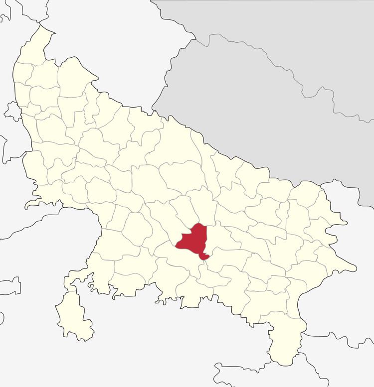
Map of Rae Bareli, Uttar Pradesh
History
Raebareli has always been a politically active district of Uttar Pradesh finding itself at the center of The Emergency. Raj Narain who opposed policies and practices of Indira Gandhi, contested against the Prime Minister in 1971 Lok Sabha elections from Rai Bareli, as a Janta Party candidate. Although he suffered a defeat, but he accused Indira Gandhi of corrupt electoral practices and filed an election petition against her. The Allahabad High Court on 12 June 1975 upheld the accusations and set aside the election of Indira Gandhi and also disqualified her to contest Lok Sabha election for next 6 years, which led to the imposition of Emergency in India. Many freedom fighters who fought against the British hail from Raebareli.A place Mushiganj situated at the bank of Sai river is also known as UP's Jallianwala Bagh.
Geography
The district had an area of 4,609 km2. The principal rivers of the district are the Ganges and the Sai: the former skirts it for 54 miles near Dalmau and is everywhere navigable for boats of 40 tons; the latter traverses it from N.W. to S.E. The principal crops are rice, pulse, wheat, barley, millet, and poppy. Rae Bareli town is connected with Lucknow by a branch of the Oudh & Rohilkhand railway, which in 1898 was extended to Benares.
Economy
In 2006 the Ministry of Panchayati Raj named Raebareli one of the country's 250 most backward districts (out of a total of 640). It is one of the 34 districts in Uttar Pradesh currently receiving funds from the Backward Regions Grant Fund Programme (BRGF).
Raebareli has also been nominated by the state government for receiving aid through central government's Smart Cities in India Programme.
Demographics
In 1901 the population was 1,033,760. According to the 2011 census Raebareli district has a population of 3,404,004, roughly equal to the nation of Panama or the US state of Connecticut. This gives it a ranking of 97th in India (out of a total of 640). The district has a population density of 739 inhabitants per square kilometre (1,910/sq mi) . Its population growth rate over the decade 2001-2011 was 18.51%. Rae Bareli has a sex ratio of 941 females for every 1000 males, and a literacy rate of 69.04%.
Languages
Languages spoken in the district include Awadhi, a vernacular in the Hindi continuum spoken by over 38 million people, mainly in the Awadh region.