
Population approx 250 Sovereign state United Kingdom Dialling code 01234 | OS grid reference TL050567 Post town BEDFORD | |
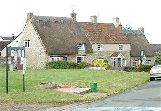 | ||
Radwell is a hamlet in the Hundred of Willey in North Bedfordshire, England, on the River Great Ouse, about 7 miles (11 km) north west of Bedford. Administratively, it is often included with the neighbouring village of Felmersham, and the Civil Parish is sometimes known as Felmersham with Radwell. According to the 2011 Census the civil parish mentioned had been renamed Felmersham and the population of Radwell was included there.
Map of Radwell, Bedford, UK
The hamlet has no church, but is part of the parish of St. Mary's, Felmersham. A chapel dedicated to St James was first recorded in 1204, but had fallen out of use by the 17th century. A Methodist chapel in Moor End Road, built in 1807, has been converted to a residence.
A public house, the Swan Inn, was first recorded as an ale house in 1728, but it has recently closed due to economic problems.
To the south, there is a stone bridge across the river. Built in 1766, it originally cost £292-10s-0d. The road leading into Radwell from the south is Radwell Road and frequently floods after heavy rain.
Between the two world wars, there was a privately run miniature railway, the Radwell Manor Railway, to the north of the settlement, which was occasionally open to the public. It was dismantled around 1940.
At the end of Moor End Road is a riding stable, and further on are Radwell lakes, a popular fishing spot with many swans.