
Area 2.91 km² | Postal code 751 21 Elevation 268 m | |
 | ||
Website | ||
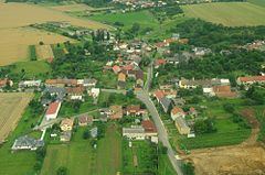
Radvanice is a village and municipality (obec) in Přerov District in the Olomouc Region of the Czech Republic.
Map of 751 21 Radvanice, Czechia
The municipality covers an area of 2.91 square kilometres (1.12 sq mi), and has a population of 289 (as at 3 July 2006).
Radvanice lies approximately 8 kilometres (5 mi) north of Přerov, 20 km (12 mi) south-east of Olomouc, and 230 km (143 mi) east of Prague.
References
Radvanice (Přerov District) Wikipedia(Text) CC BY-SA