
 | ||
Radial Road 2, more commonly referred to as R-2, is a network of roads and bridges that altogether form the second arterial road of Manila in the Philippines. The road runs north-south linking the City of Manila to the Metro Manila cities of Pasay, Parañaque and Las Piñas, down to Bacoor, Imus, Dasmariñas, Silang and Tagaytay in the province of Cavite.
Contents
- Map of R 2 Philippines
- Route
- Taft Avenue
- Elpidio Quirino Avenue
- Diego Cera Avenue
- Aguinaldo Highway
- References
Map of R-2, Philippines
Route
The road consists of the following segments from north to south:
Taft Avenue
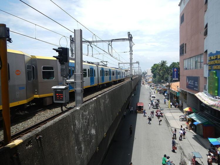
Between its northern terminus at the Lagusnilad tunnel of Padre Burgos Avenue and Redemptorist Road in Pasay, R-2 is known as Taft Avenue. It serves the districts of Ermita and Malate running underneath the Manila Light Rail Transit System Line 1 (LRT-1) towards Parañaque via Pasay.
Elpidio Quirino Avenue
Taft Avenue merges with Elpidio Quirino Avenue in the intersection with Redemptorist Road at the Pasay–Parañaque border. This section of R-2 runs the entire length of Parañaque from Baclaran to San Dionisio.
Diego Cera Avenue
R-2 is known as Diego Cera Avenue in Las Piñas. It runs between Villareal Street in the San Dionisio–Manuyo Uno border and Alabang–Zapote Road in Zapote.
Aguinaldo Highway
From Alabang–Zapote Road south to Tagaytay, R-2 is known as Aguinaldo Highway. It is the main north-south thoroughfare in the province of Cavite linking Las Piñas, Metro Manila with the Cavite cities and municipalities of Bacoor, Imus, Dasmariñas, Silang and Tagaytay. R-2 ends at the Tagaytay Rotunda by the Taal Lake before the highway turns west along the ridge to Batangas.