
Area rank 379 in Norway Area 111.4 km² | Demonym(s) Radværing Population 5,039 (2014) | |
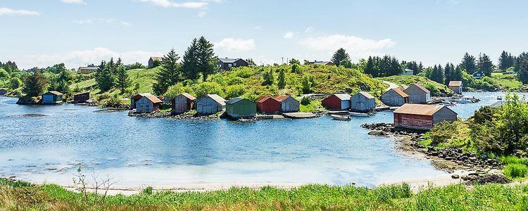 | ||
From gotnes to mongstad with a trip to rad y
Radøy is an island municipality in the Nordhordland district in Hordaland county, Norway. The municipality includes almost all of the island of Radøy plus many small surrounding islands. The administrative centre of the municipality is the village of Manger. Other villages in the municipality include Askeland, Austmarka, Bøvågen, Haugland, Sæbø, and Sletta.
Contents
- From gotnes to mongstad with a trip to rad y
- Map of RadC3B8y Norway
- General information
- Name
- Coat of arms
- Churches
- Government
- Municipal council
- Mayor
- Geography
- References
Map of Rad%C3%B8y, Norway
General information
The municipality of Radøy was created as a new municipality on 1 January 1964, after a major municipal merger. The new municipality was constructed from parts of several different municipalities:
Name
The municipality was named after the island on which it sits, Radøy. The Old Norse form of the island's name was (just) Röð. (The last element øy meaning "island" was added later.) The name is identical with the word röð for "row" or "ridge" (here in the sense "long island" sticking out of the ocean).
Coat-of-arms
The coat-of-arms is from modern times; they were granted on 16 June 1991. The arms shows two black oarlocks on a yellow background. Oarlocks are on the gunwale of a boat and they support the oar and give force to the rower's stroke. Some of these objects have been found in several places in Radøy and the artifacts date back to the first century BC. The designer of the arms was Even Jarl Skoglund.
See also: the coats of arms of Fosnes and TjømeChurches
The Church of Norway has one parish (sokn) within the municipality of Radøy. It is part of the Nordhordland deanery in the Diocese of Bjørgvin.
Government
All municipalities in Norway, including Radøy, are responsible for primary education (through 10th grade), outpatient health services, senior citizen services, unemployment and other social services, zoning, economic development, and municipal roads. The municipality is governed by a municipal council of elected representatives, which in turn elect a mayor.
Municipal council
The municipal council (Kommunestyre) of Radøy is made up of 25 representatives that are elected to every four years. For 2011–2015, the party breakdown is as follows:
Mayor
The mayor is Jon Askeland, and the deputy mayor is Ann Christin Hoen.
Geography
The municipality encompasses all of the island of Radøy, except the far southern tip (which belongs to Lindås municipality. The smaller surrounding islands of Toska, Bognøy, Fesøy, and others are also part of Radøy municipality. The Radfjorden separates Radøy municipality from the municipality of Meland to the south. The Radsundet strait separates the municipality of Radøy from the municipality of Lindås to the east. The island of Fosnøyna (in Austrheim) lies to the north. The islands of Øygarden lie across the Hjeltefjorden to the west.