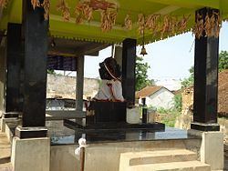
Founded by Unknown Population 1,292 (2014) | Mandal Maddiapdu Time zone IST (UTC+5:30) Area code 08592 | |
 | ||
Rachavaripalem is a village in Maddipadu mandal in Prakasam district in the state of Andhra Pradesh in India.
Contents
Map of Rachavaripalem, Andhra Pradesh 523211
Location
Rachavaripalem is 20 km from Ongole, 3 km from NH45. It is surrounded by River Gundlakamma on three sides of village.
Demographics
As of 2014 India census, Rachavaripalem had a population of 1,292. Of 578 Males and 714 Females. Having total houses of 551.
Schools and colleges
For comprehensive information, Please visit AP smart Village report http://www.smart.ap.gov.in/myvillage/jsp/supervisor/mis/reportcard.jsp?state=1,AndhraPradesh&district=10,Prakasam&constituency=89,Santhanuthalapadu&mandal=380,Maddipadu&revenuevillage=5028,Rachavari%20Palem&panchayat=6680,Rachavari%20Palem&selectionkey=panchayat&back=index
References
Rachavaripalem Wikipedia(Text) CC BY-SA
