
Intercommunality Pays de Tarascon Area 26.96 km² Population 264 (1999) | Region Occitanie Time zone CET (UTC+1) Local time Wednesday 4:36 PM | |
 | ||
Weather 14°C, Wind W at 11 km/h, 32% Humidity | ||
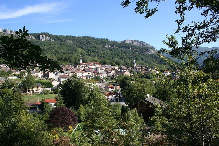
Rabat-les-Trois-Seigneurs is a commune in the Ariège department in the Midi Pyrénées region in southwestern France.
Contents
- Map of 09400 Rabat les Trois Seigneurs France
- Population
- Name
- Geography
- History
- Sights
- Personalities
- References
Map of 09400 Rabat-les-Trois-Seigneurs, France
Population
The inhabitants of Rabat are called Rabatols in Occitan (the historical local language) or Rabatois.
Name
The real name of the village is Rabat, but since 1931 the French post office administration has decided that the name has to be labelled as Rabat-les-Trois-Seigneurs to avoid a confusion with the city of Rabat in Morocco. Note that the village was called Rabat since Charlemagne in the 8th century, four centuries before Rabat in Morocco that was founded only in 1150. The expression "les trois seigneurs" means in French "of the three lords". It is a reference to a mountain called "Le pic des trois seigneurs" that close the Courbière valley in which Rabat is settled. The name come from the fact that three valleys (Courbière, Vicdessos, Couserans) are closed by this peak. As each of the valleys has a different lord, the peak is a place common to three lords and so is called "Peak of the three lords". A legend said that every year in summer, the three lords met on the flat stone at the top of the peak and discussed together.
Geography
The village of Rabat is settled in the valley of the Courbière, a mountain river. Most of the 15 km of the river are on the village territory.
History
Man has settled in the valley of the Courbière since more than 17,000 years. Many archeologic pieces from magdalenian (cavern of Bédheilac) have been found in the valley.
Sights
Rabat church's older portion was built in the 10th century and has a famous wooden altarpiece.