
Province Leinster | ||
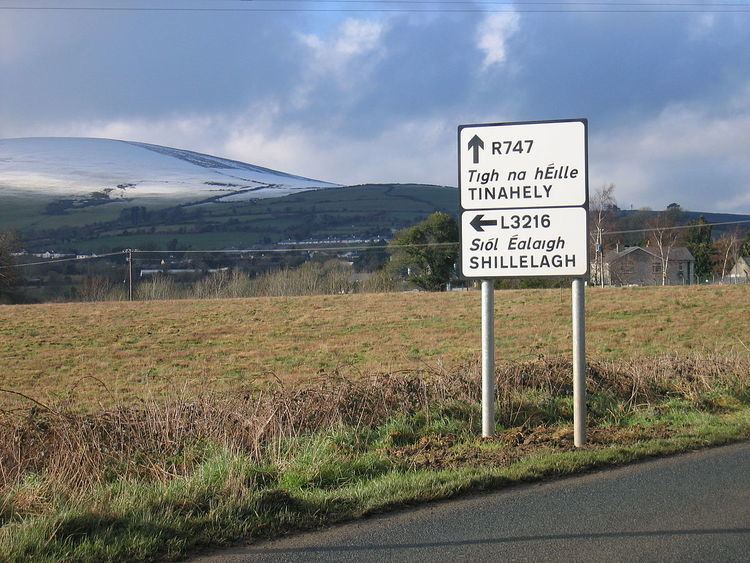 | ||
The R747 road is a regional road in Ireland running north-west/south-east from the M9 near Ballitore in County Kildare to Arklow in County Wicklow, a distance of 66 km (41 mi).
Contents
Map of R747, Arklow, Co. Wicklow, Ireland
From its junction with the M9 it heads east to the former N9. It crosses this at a staggered junction and enters County Wicklow almost immediately and 10 km (6.2 mi) southeast it crosses the N81 in the town of Baltinglass. It continues southeast through Kiltegan before crossing into County Carlow for a short distance where it passes through Hacketstown. Back in County Wicklow it crosses the Wicklow Way and enters the southern end of the Wicklow Mountains near Tinahely.
From Tinahely it heads northwest for 14 km (8.7 mi) to Aughrim, and then east along the valley of Aughrim River to Woodenbridge where it is joined by the R752. The final leg of its eastward route is through the valley of the River Avoca which takes it under (though not connecting to) the N11 before terminating in the centre of Arklow.
R747 extension
As part of the construction of the M9 motorway from Kilcullen to Waterford the R747 was extended westwards by 2 km from the old N9/R747 junction to Junction 3 of the motorway. Both the Kilcullen - Carlow section of the M9 and the R747 extension opened on 20 December 2009. A link road from this interchange to Athy was opened in December 2009.