
 | ||
R3 Highway is a primary road in Zimbabwe from the capital city Harare to Chirundu.
Contents
Background
The highway is also known as the Harare-Chirundu Highway. Its historical and popular name is the A1 Highway and is 354 kilometres (220 miles) long. In Harare it can be picked up at the intersection of Samora Machel Avenue (A5) and Leopold Takawira Street. Follow Leopold Takawira north and turn right into Hebert Chitepo Avenue, then left into Sam Nujoma Street up to Lomagundi Road (A1) at coordinates 17.78351°S 31.038427°E / -17.78351; 31.038427 ((A1/R3) Lomagundi Road), and from Chirundu it can be picked from the Chirundu Bridge or the Otto Beit Bridge. ( 16.04187°S 28.86148°E / -16.04187; 28.86148 ((A1/R3 Highway) Chirundu Border Post) )
Pan African Highway Link
Together with the R1 Highway which runs from Harare to Beitbridge, the R3 Highway is part of the North-South Corridor which is the Cairo-Cape Town Highway. Chirundu to Beitbridge is 897 kilometres (557 miles).
The Trans-African Highway 4, alias the Cairo-Cape Town Highway, is a road network being developed with the collaboration of the African Union, the United Nations Economic Commission for Africa and the African Development Bank. Its length is about 10,228 kilometers connecting Cape Town and Cairo, along with Botswana, Zimbabwe, Zambia, Tanzania, Kenya, Ethiopia, and the Sudan. There are two possible routes in Zimbabwe connecting Zambia and South Africa. The first is from Lusaka to Beitbridge via Victoria Falls and the other is from Lusaka to Beitbridge via Chirundu, Zimbabwe. The Chirundu Route is shorter but not the fastest. For Trans-African Highway transporters, both Zimbabwean routes are slower and costly.
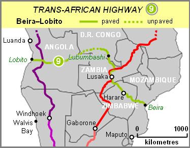
Together with the R5 Highways it forms part of the Beira-Lobito Highway which is the Trans-African Highway Network route number 9.
Rehabilitation
The A1 Highway is currently under rehabilitation together with other regional road corridors in Zimbabwe. Most highways in Zimbabwe are more than 30 years old, outliving their 20-year life span, and they need rehabilitation. The rehabilitation of this highway is in conformation of the Sadc Regional Infrastructure Master Plan for the North-South Corridor (Africa). North-South Corridor (Africa) is a passage for Southern Africa Development Community (Sadc) exports to the North, and imports to the South. It is important in the handling of regional traffic within Sadc and Comesa.
Waypoints
Waypoints from South to North; Harare to Chirundu.
Banket
The first significant waypoint from Harare is Banket. This waypoint is usually overlapped by motorists because it is only 24.7 km (15.3 mi) before Chinhoyi. -17.38333, 30.4
Chinhoyi
Entering Chinhoyi, the first billboard encountered just after the Manyame Bridge notifies one of a rest place just a kilometre away. Ten years from opening its doors, the Chinhoyi University of Technology Hotel has become a favourite stop-over for travellers along the Harare-Chirundu Highway. When you live Chinhoyi towards Karoi about 10 kilometres (6.2 miles) north, (that’s about 136 kilometres (85 mi) from Harare and about before 251 kilometres (156 mi) from Chirundu Border Post is the Chinhoyi Caves Recreational Park, besides the road. The caves are a network of tunnels and caverns which are fascinating places to visit. The water temperature of the Chinhoyi caves is always at 22 degrees Celsius (72 Fahrenheit). The caves are a stopover option for those not wanting to stop in town. Open hours are 0700 hrs to 1700 hrs (GMT).
Karoi
Karoi is about 85 kilometres (53 miles) by road, north-west of Chinhoyi, or about 200 kilometres (120 miles) from Harare and 154 kilometres (96 miles) before Chirundu.
About 8 kilometres (5.0 mi) north of Karoi towards Makuti, the Karoi-Gokwe-Binga Roads turns right and eventually reaches Matusadona National Park. Sanyati Bridge is 115 kilometres (71 mi) along this road, west.
Makuti
Makuti is the last significant waypoint before Chirundu. The M15 highway branches sharply right here to Kariba through to Zambia’s Siavonga Border Post via the Kariba Dam wall.
Marongora
Marongora Wildlife Campsite is about 168 kilometres (104 mi) from Chinhoyi towards Chirundu, that is just more than 267 kilometres (166 mi) northwest of Harare. Tickets to Manna Pools are obtained here. 16.223297°S 29.161436°E / -16.223297; 29.161436 (Marongora Wildlife Office)
Marongora Map External link. Marongora Office Photo External link.
Bridges
There are several high-level bridges along the highway. However, in during the floods of January 2015 some bridges between Chinhoyi and Karoi flooded, a very rare scenario. Chikuti River Bridge was blocked by flowing water near Lion’s Den before Mhangura Road turn-off. and Denga River Bridge was also blocked.