
Country Norway District Helgeland Area rank 156 in Norway Area 711.3 km² Local time Saturday 10:46 PM | County Nordland Administrative centre Vågaholmen Demonym(s) Rødøyfjerding Population 1,294 (2011) Official language form Norwegian Language | |
 | ||
Weather 3°C, Wind SW at 18 km/h, 94% Humidity Points of interest Saltfjellet–Svartisen National Park, Nordskaghella, Rødøyløva, Langstranda, Steet, Grønlistranda | ||
Rødøy is a municipality in Nordland county, Norway. It is part of the Helgeland traditional region. The administrative centre of the municipality is the village of Vågaholmen. Other villages include Gjerøy, Jektvika, Kilboghamn, Melfjorden, Oldervika, Sørfjorden, and Tjong. The municipality consists of many islands to the west of Norway's second biggest glacier, Svartisen.
Contents
- Map of RC3B8dC3B8y Norway
- General information
- Name
- Coat of arms
- Churches
- Geography
- Government
- Municipal council
- References
Map of R%C3%B8d%C3%B8y, Norway
General information
The municipality of Rødøy was established on 1 January 1838 (see formannskapsdistrikt). On 1 January 1884, the northern district of Rødøy was separated to form the new municipality of Meløy. This division left Rødøy with 1,945 residents. The borders of the municipality have not changed since that time.
Name
The Old Norse form of the name was Rauðøy. The first element is rauðr which means "red" (probably referring to the color of the rocks of the island) and the last element is øy which means "island".
Coat-of-arms
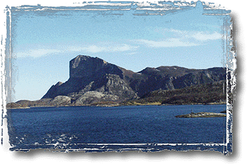
The coat-of-arms is from modern times; they were granted on 12 February 1988. The arms show a red lion on a silver background symbolizing the mountain called Rødøyløva (English: the lion of Rødøy) because its profile resembles a lion. (See picture). It is not the highest mountain in the municipality, however, Blokktinden is one that is higher.
Churches
The Church of Norway has two parishes (sokn) within the municipality of Rødøy. It is part of the Nord-Helgeland deanery in the Diocese of Sør-Hålogaland.
Geography
The eastern part of Rødøy is located on the mainland, just east of the Saltfjellet mountain range. The rest of the municipality consists of islands to the west including Gjerdøya, Hestmona, Myken, Nesøya, Rangsundøya, Renga, and Rødøya. The westernmost part of the municipality is the Myken islands in the Vestfjorden, where the Myken Lighthouse is located.
The Tjongsfjorden is located in the northern part of the mainland of Rødøy, just north of the mountain Blokktinden. The Melfjorden is located in the southern part of the mainland, flowing out of the Saltfjellet–Svartisen National Park.
Government
All municipalities in Norway, including Rødøy, are responsible for primary education (through 10th grade), outpatient health services, senior citizen services, unemployment and other social services, zoning, economic development, and municipal roads. The municipality is governed by a municipal council of elected representatives, which in turn elect a mayor.
Municipal council
The municipal council (Kommunestyre) of Rødøy is made up of 17 representatives that are elected to every four years. Currently, the party breakdown is as follows: