
District Gifhorn Time zone CET/CEST (UTC+1/+2) Area 10.83 km² Local time Saturday 10:33 PM Dialling code 05304 | Elevation 67 m (220 ft) Postal codes 38531 Population 2,345 (31 Dec 2008) Postal code 38531 Municipal assoc. Papenteich | |
 | ||
Weather 7°C, Wind N at 5 km/h, 72% Humidity | ||
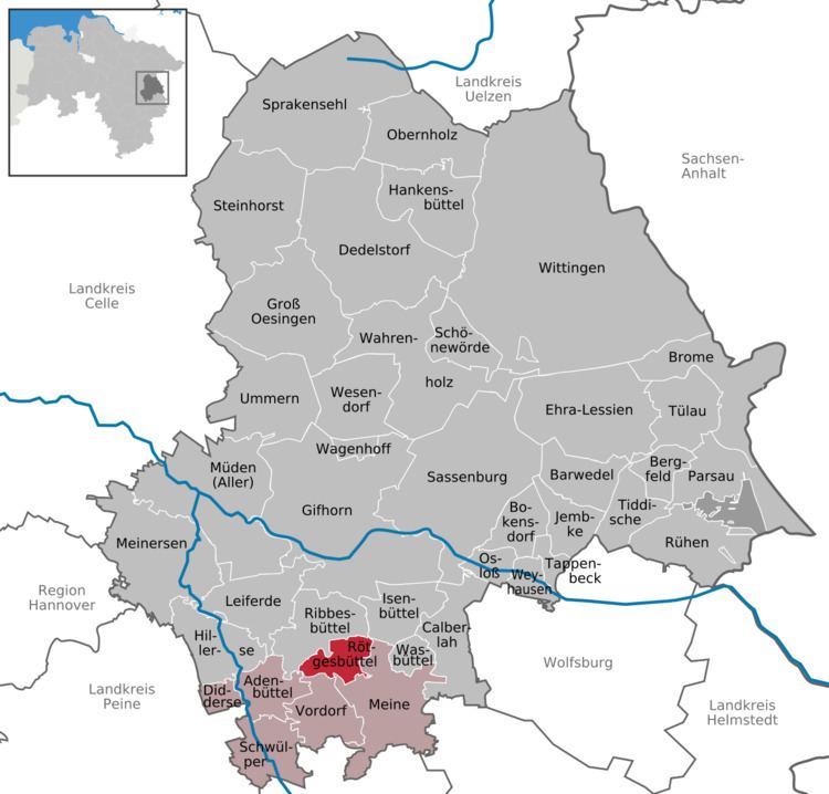
Rötgesbüttel is a municipality in the district of Gifhorn, in Lower Saxony, Germany. It is a member municipality of the Samtgemeinde Papenteich
Contents
- Map of RC3B6tgesbC3BCttel Germany
- Neighbourhood
- Geographical position
- History
- Municipal Council
- References
Map of R%C3%B6tgesb%C3%BCttel, Germany
Neighbourhood
* distance from downtown
Geographical position
Rötgesbüttel is situated north of Braunschweig, between the Harz and the Lüneburg Heath. It is situated at the German highway 4 and around 13 km to the north of the interchange Brunswick North (A2 /A391). Administrative it belongs to the district of Gifhorn. Other bigger towns nearby are: Wolfsburg, Salzgitter, Wolfenbüttel, Gifhorn, Peine and Celle.
History
The first documentary mentioning of Rötgesbüttel was in the year 1226. In former times the village was known as Rotlekesbutle . As most of the so-called “-büttel” villages it is expected that Rötgesbüttel may erected earliest in 10th century. In the Middle Ages Rötgesbüttel the crossing traffic of a trade road from Braunschweig to Hamburg influenced the villages development.
Municipal Council
The council of the Municipality Rötgesbüttel consists of 12 councilmen and woman:
(Status: community election 10. September 2006 with a voter participation of 59,80%)